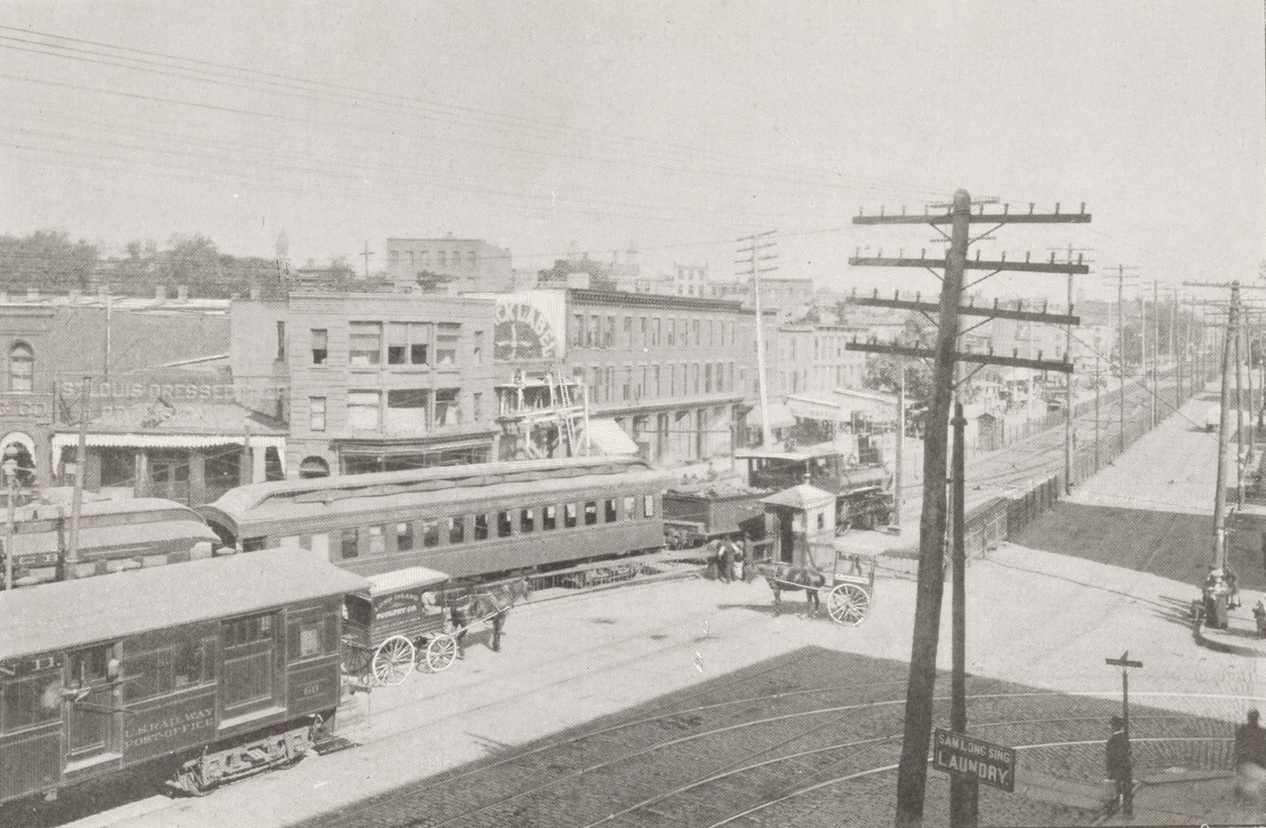
"People have lived on Brooklyn's Atlantic Avenue almost as long as there has been an Atlantic Avenue. It started out as a path leading to early settler Ralph Patchen's farm and then became a road to the East River. Part of it became known as Division Street, as it was the informal border between the town of Brooklyn and South Brooklyn, which included today's Red Hook, Cobble Hill and Carroll Gardens neighborhoods."
"By the 1850s, the entire road was known as Atlantic Street. By the 1870s, the street became an avenue. From the riverfront to Flatbush Avenue, it was a bustling shopping and commercial district. Businesses near the river catered to the sea trade, along with retail storefronts of all kinds. This busy area also supported civic institutions and bank buildings, factories, houses of worship, restaurants, and saloons."
"From the first tenements housing nearby riverfront factory workers to the lively blocks of mixed-use storefronts with apartments above and the late 20th century factory conversions, this part of Atlantic Avenue has long been home to thousands of people over the past two centuries. But other parts of the long avenue? Some yes, much not so much. But that is changing rapidly."
"This story concentrates on Atlantic Avenue as it runs through Brooklyn from Flatbush Avenue and the Barclays Center towards Queens. The tale concludes at Eastern Parkway before the subway lines intersect at Broadway Junction. Along the way, Atlantic Avenue delineates the borderline between the communities of Fort Greene, Clinton Hill, and Bedford Stuyvesant to the north and Prospect Heights and Crown Heights to the south."
Atlantic Avenue began as a path to Ralph Patchen's farm and became a road to the East River, known variously as Division Street, Atlantic Street, and eventually Atlantic Avenue. The stretch from the riverfront to Flatbush Avenue developed into a bustling commercial district serving sea trade, retail, civic institutions, banks, factories, houses of worship, restaurants, and saloons. Housing on the avenue ranged from tenements for factory workers to mixed-use storefronts and late 20th-century factory conversions, accommodating thousands over two centuries. Several other sections lagged in development but are rapidly changing. The avenue marks neighborhood boundaries as it runs toward Eastern Parkway.
Read at Brownstoner
Unable to calculate read time
Collection
[
|
...
]