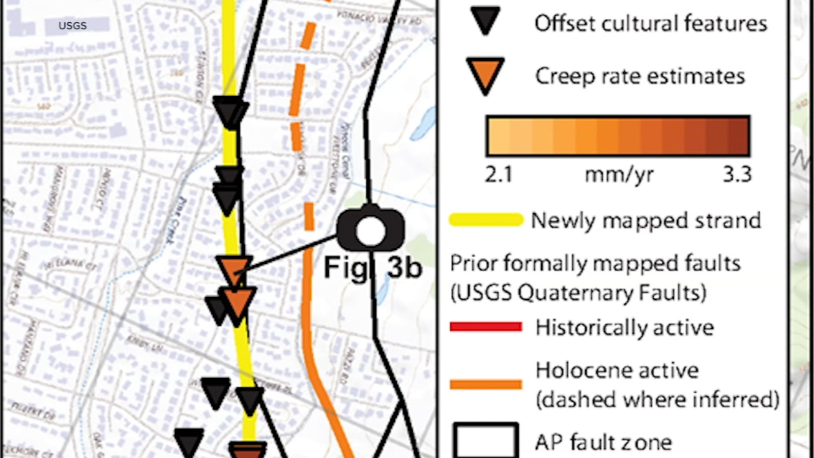
"New research indicates that the Concord Fault, capable of triggering a significant earthquake, is located a quarter mile west of its previously mapped position. This fault extends approximately 20 miles through Walnut Creek and Concord, with a newly identified stretch of nearly 4.5 miles in the Ygnacio Valley area. Reports from neighbors about broken water lines and shifting sidewalk edges helped researchers uncover this new information. Such findings may influence construction regulations and property values in proximity to the fault."
"The Concord Fault is about a quarter mile west of its original mapping, with implications for understanding earthquake risks in the region. The newly discovered segment of the fault in the Ygnacio Valley area showcases the importance of community input in scientific research, as local residents reported physical changes indicative of geological activity. The potential impact on construction standards and property values emphasizes the relevance of accurate fault mapping for urban planning and disaster preparedness."
Research has revealed that the Concord Fault, previously thought to be located elsewhere, is situated about a quarter mile west of its original mapping. It runs approximately 20 miles through Walnut Creek and Concord, with a newly identified stretch of nearly 4.5 miles in the Ygnacio Valley area. Observations made by neighbors, including broken water lines and shifting sidewalks, alerted scientists to the need for re-evaluation. This find could modify construction standards and impact property values near the fault's vicinity.
Read at ABC7 San Francisco
Unable to calculate read time
Collection
[
|
...
]