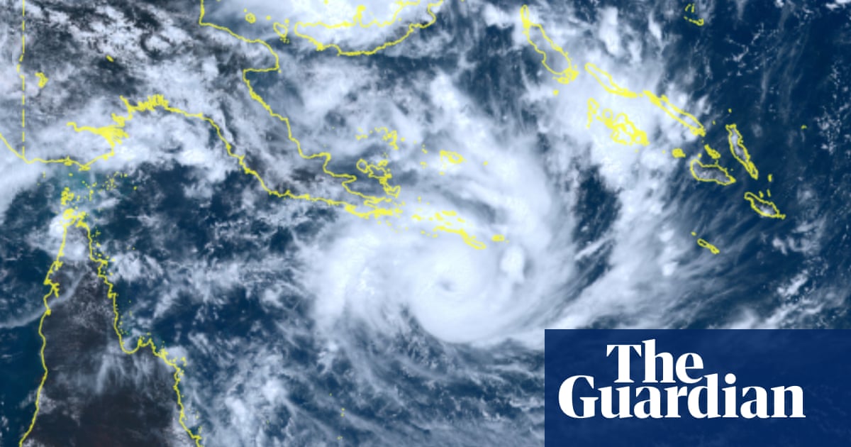
"Narelle formed on Tuesday evening, south of Solomon Islands, and on Wednesday was heading towards the far north Queensland coast. Sue Oates from the Bureau of Meteorology said the storm had a 90% chance of heading west, making landfall likely near Coen on Friday. On Wednesday afternoon, Narelle had intensified to a category 3 cyclone."
"An estimate of wind gusts at that time is about 200 to 250 km/h, noting that's the intense core around the eye of the system, with the destructive winds extending out from that core. Oates also warned of intense rainfall, flash flooding and strong tides."
"This may be the biggest system that many people have seen in living memory, and that's why we're asking people to prepare as we have. He urged people to use Wednesday to prepare or evacuate. Queensland police's disaster coordinator Chris Stream warned of potential loss of life."
Tropical Cyclone Narelle formed south of Solomon Islands on Tuesday and intensified to category 3 by Wednesday afternoon. The Bureau of Meteorology estimates a 90% probability of westward movement with landfall likely near Coen on Friday. Wind gusts in the intense core reach 200-250 km/h, with destructive winds extending outward. Additional hazards include intense rainfall, flash flooding, and strong tides. Queensland authorities are evacuating vulnerable populations and deploying emergency resources. Lizard Island's luxury resort and Australian Museum coral research station have been evacuated with essential staff remaining under cyclone shelter protocols. Officials warn this may be the largest cyclone many residents have experienced and urge immediate preparation or evacuation.
#tropical-cyclone-narelle #cape-york-landfall #extreme-weather-evacuation #natural-disaster-preparedness #queensland-emergency-response
Read at www.theguardian.com
Unable to calculate read time
Collection
[
|
...
]