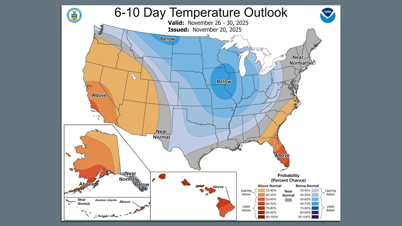
""Below normal temperatures are favored for the Central and Northern U.S., including northern parts of the Pacific Northwest, the Great Plains, parts of Texas, and the interior Mid-Atlantic," the NWS said in posts to its social media accounts."
""These two factors plus La Niña are set to "drive winter-like conditions across much of the U.S. late November into early December," according to the weather agency. Threat level: The frigid temperatures are set to coincide with peak holiday travel this week - as nearly 82 million Americans are expected to embark on Thanksgiving holiday road trips and the TSA prepares to screen an estimated 17.8 million air travelers from this Tuesday.""
"Zoom in: There's a "moderate risk of heavy snow for the Central Rockies" from Nov. 29-Dec. 1 and for the Upper Great Lakes and the Interior Northeast Nov. 29-30, "driven by the potential for lake-effect snow," per the NWS' Climate Prediction Center."
Below-normal temperatures are favored across the Central and Northern U.S., including the northern Pacific Northwest, the Great Plains, parts of Texas, and the interior Mid-Atlantic. La Niña combined with an active Madden–Julian Oscillation and other atmospheric patterns is expected to drive winter-like conditions late November into early December. A moderate risk of heavy snow is forecast for the Central Rockies Nov. 29–Dec. 1 and for the Upper Great Lakes and Interior Northeast Nov. 29–30, with potential for lake-effect snow. Broader slight snow risks extend across much of the Rockies and the Northern Tier corridor. The cold snap will coincide with peak Thanksgiving travel and may persist into mid-December. Research continues on links between a warming climate and polar vortex excursions.
Read at Axios
Unable to calculate read time
Collection
[
|
...
]