"New York City is a city of walkers. More trips are made on foot than by car (41% versus 28%) and the city's "80X50" climate action plan envisions that 80% of all trips by 2050 will be made either on foot, by biking, or by public transit. The problem is that pedestrian movement in the city has remained largely unmapped and underestimated-until now."
"Over the past decades, transportation agencies have become experts at modeling traffic and predicting vehicle flows, but as Sevtsuk points out in a study accompanying the model that was published in the journal Nature Cities, "what gets counted, counts." The amount of transportation infrastructure funding that states receive from the Federal Highway Administration, for example, relies on vehicle miles traveled in that state."
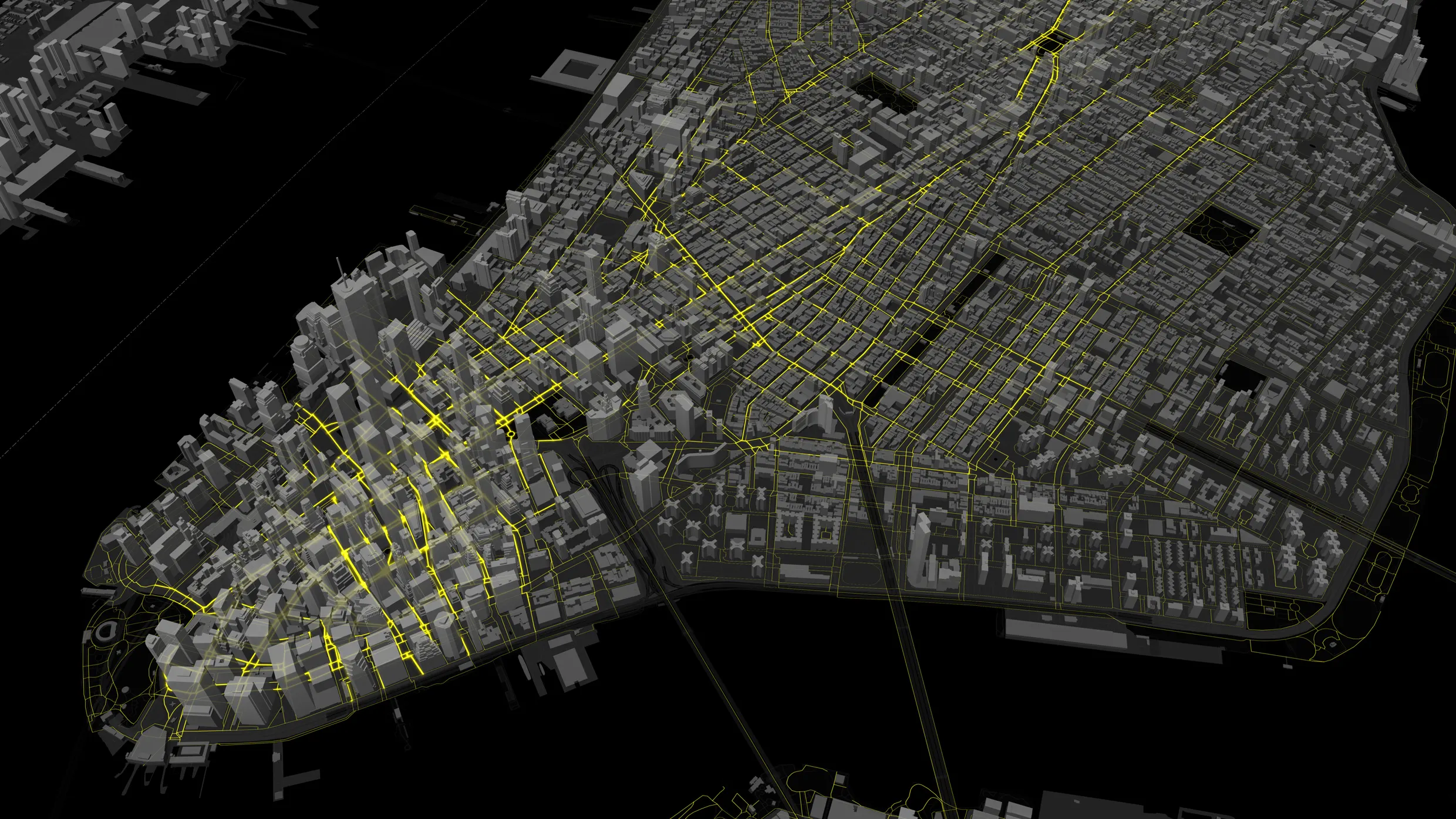
A complete model of pedestrian activity maps foot traffic across all sidewalks, crosswalks, and footpaths in New York City during peak periods. The model reveals surprising movement patterns and identifies where pedestrians are most vulnerable to vehicle crashes, with high-risk locations occurring outside Midtown Manhattan. Accurate pedestrian counts can influence funding allocations because current federal transportation funding formulas are tied to vehicle miles traveled, which favors car-centric infrastructure. Applying the model in other U.S. cities can enable people-oriented infrastructure planning by quantifying walking, biking, and transit trips to support safety and climate goals.
Read at Fast Company
Unable to calculate read time
Collection
[
|
...
]