"The northern plains of Mars feature distinct geological boundaries between the southern highlands and northern lowlands extending for thousands of kilometres, which have been used to infer ancient ocean shorelines."
"Two explanations have been proposed to explain this long-wavelength deviation in putative shoreline elevation: true polar wander and the Tharsis-induced deformation model."
"Reconstructing even geologically recent palaeolake levels based on putative shorelines is challenging because of erosion and deformation."
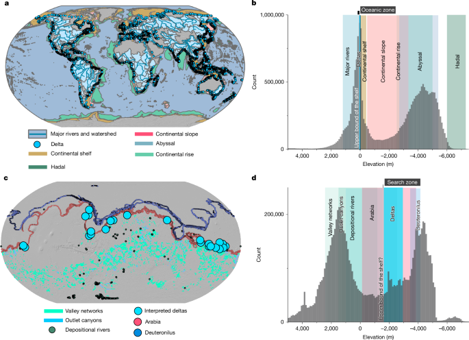
"Rather than a distinct shoreline imprint, the main topographic feature of the modern ocean is the band of low-gradient terrain that bounds most continents."
The northern plains of Mars show geological boundaries that imply ancient ocean shorelines, specifically the Arabia and Deuteronilus shorelines. However, significant elevation deviations from expected levels raise doubts about these features being true shorelines. Two main theories explain these deviations: true polar wander and Tharsis-induced deformation. Additionally, misidentification of features and resurfacing events complicate the interpretation. Previous reconstructions of Martian oceans based on topographic breaks face challenges due to erosion and deformation, questioning the validity of these shorelines as indicators of a long-lived ocean.
Read at Nature
Unable to calculate read time
Collection
[
|
...
]