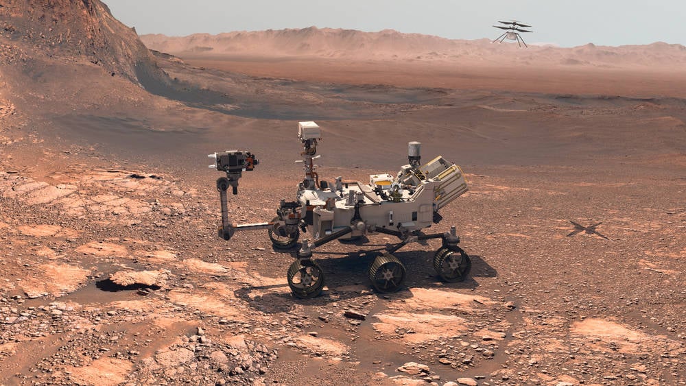
"It did so with the blessing of engineers at NASA's Jet Propulsion Laboratory (JPL), who decided to delegate the meticulous work of route planning to Anthropic's AI model. This involves consulting orbital and surface imagery of Mars in order to set a series of waypoints to guide the rover's movements. Once plotted, this data gets transmitted about 140 million miles or 225 million kilometers - the average distance from Earth to Mars - where it's received by Perseverance as a navigational plan."
"Perseverance has an AutoNav system that handles real-time decision making. "AutoNav allows the rover to autonomously re-plan its route around rocks or other obstacles on its way to a pre-established destination," NASA explains. The re-planning may not be needed if the pre-planning went well. The pre-planning is "time-consuming" and "laborious," as Anthropic puts it, so JPL researchers decided to let Claude - using its vision capabilities - have a go."
Perseverance traveled about 400 meters on Mars using a navigation path generated by Anthropic's Claude, approved by engineers at NASA's Jet Propulsion Laboratory (JPL). Route planning typically involves analyzing HiRISE orbital imagery and digital elevation models to identify terrain features and set waypoints, then transmitting the plan across roughly 140 million miles to the rover. Perseverance's AutoNav system can re-plan around obstacles in real time, reducing dependence on perfect pre-planning. Pre-planning is time-consuming and laborious, so JPL delegated waypoint generation to Claude, which analyzed imagery and terrain-slope data to detect hazards and propose safe routes.
Read at Theregister
Unable to calculate read time
Collection
[
|
...
]