A potent late-January 2026 winter storm deposited heavy snow, sleet, and ice from the U.S. Southwest through the Midwest to New England, accompanied by bitterly cold temperatures. Snow totals reached up to 12 inches in parts of Oklahoma and about 20 inches in several Northeast locations, with record daily amounts in cities such as St. Louis (5.1 inches) and Pittsburgh (11.2 inches). Sleet and snow affected portions of North Texas. Treacherous travel conditions toppled power lines and forced widespread school closures. NASA's Disasters Response Coordination System activated to support federal partners and will publish maps and data products on an open-access mapping portal.
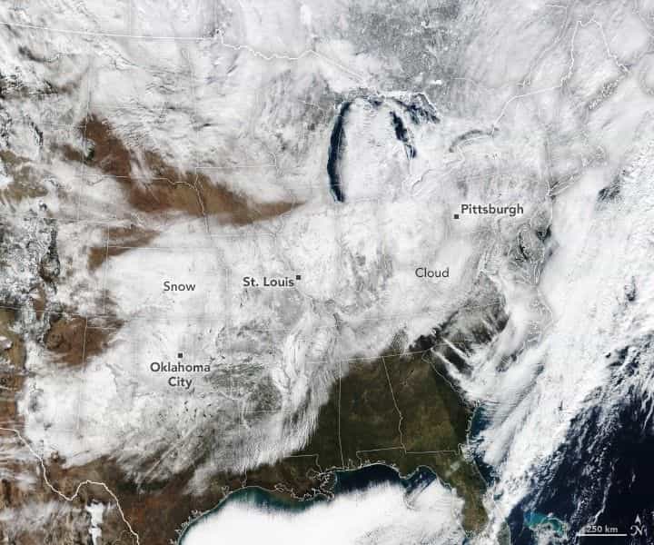
"The heavy snow, along with bitterly cold temperatures, sleet, and ice, created treacherous travel conditions, toppled power lines, and caused widespread school closures, according to news reports. On the afternoon of January 26, the VIIRS (Visible Infrared Imaging Radiometer Suite) on the Suomi NPP satellite observed new snow covering a large swath of the country. The top image is natural color, while the false-color image below uses a combination of visible and infrared light ( bands M11-I2-I1) to distinguish snow (blue) from clouds (white)."
"Preliminary National Weather Service data indicate snow accumulations of up to 12 inches (30 centimeters) in parts of Oklahoma between the mornings of January 23 and January 26, with higher accumulation across the Midwest and in New England. Totals of around 20 inches were reported in several Northeast states. Some locations were digging out from record daily accumulations, including 5.1 inches in St. Louis, Missouri, on January 24, and 11.2 inches in Pittsburgh, Pennsylvania, on January 25."
Read at SnowBrains
Unable to calculate read time
Collection
[
|
...
]