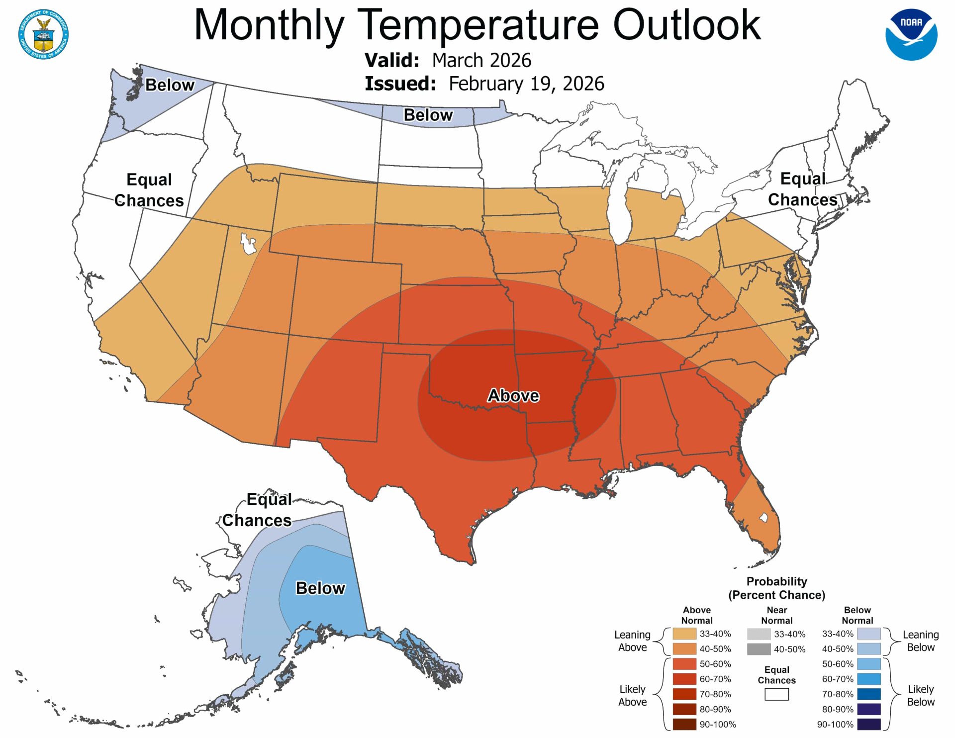
Warmer, drier weather is favored for much of the southern and central United States in March, while storms concentrate on the Pacific Northwest, northern Rockies, Great Lakes, and Ohio Valley. The atmosphere is shifting toward a late-season La Niña pattern, pushing the main storm track north and allowing milder Pacific air to affect the interior. Warmer-than-normal conditions are likely across the Rockies, Plains, Midwest, and East, strongest in the south‑central Plains and lower Mississippi Valley. Colder-than-normal temperatures are most likely in Alaska and portions of the northern High Plains and Pacific Northwest. Mountain regions show mixed signals, with higher snow lines in southern ranges and more snow potential near the Canadian border.
"Federal climate forecasters say the atmosphere is shifting into a more typical late-season La Niña setup, with the main storm track sliding north as milder air flows in from the Pacific. That favors warmer-than-normal conditions across most of the Rockies, Plains, Midwest, and East, with the strongest signal for warmth centered on the south-central Plains and lower Mississippi Valley. Colder-than-normal temperatures are most likely in Alaska and may clip parts of the northern High Plains and Pacific Northwest."
"Pacific Northwest and northern Rockies: Slightly cooler-than-average temperatures are possible near the Canadian border and in parts of Washington, northern Idaho, and Montana, increasing the odds that incoming storms fall as snow at ski elevations. Farther south into Oregon, Idaho's central ranges, Wyoming, and Utah, odds tilt warmer than normal, so snow levels may run higher even when storms pass through."
Read at SnowBrains
Unable to calculate read time
Collection
[
|
...
]