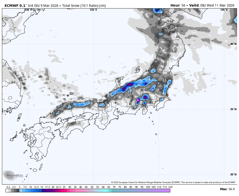
"From Monday evening, March 9, through Tuesday night, March 10, the models are tightly grouped on a widespread shot of snow, with the best lift-served payoff in central Honshu. Timing is one of the cleaner parts of the forecast: snow fills in Monday night, peaks from late Tuesday morning into Tuesday evening, and dwindles into lighter leftovers on Wednesday."
"The strongest first-round totals cluster in central Honshu, where Akakura Onsen looks good for 14 cm-19 cm, Okushiga for 13 cm-16 cm, and Gala Yuzawa for 12 cm-16 cm, while much of Hokkaido is closer to a 4 cm-6 cm refresh aside from a better 13 cm-17 cm signal around Kiroro."
"Another storm is favored from Thursday afternoon, March 12, into Friday, March 13, but confidence drops a step because the models agree on the arrival window more than they agree on who gets the biggest payoff. They still converge on snow redeveloping Thursday afternoon or evening and peaking Thursday night into Friday morning, with western Hokkaido carrying the clearest upside."
A high-confidence snow system impacts Japan from Monday evening, March 9, through Wednesday afternoon, March 11, with central Honshu positioned for the best conditions. Snow begins Monday night, peaks Tuesday morning through evening, and tapers Wednesday. Snow levels remain near sea level to 200 meters, ensuring cold conditions across resorts. Central Honshu resorts like Akakura Onsen, Okushiga, and Gala Yuzawa expect 12-19 cm accumulations with solid snow quality and manageable winds. Hokkaido receives lighter amounts around 4-6 cm except Kiroro with 13-17 cm. A secondary storm system Thursday afternoon into Friday shows lower confidence but favors western Hokkaido with potential 30-60 cm accumulations.
Read at SnowBrains
Unable to calculate read time
Collection
[
|
...
]