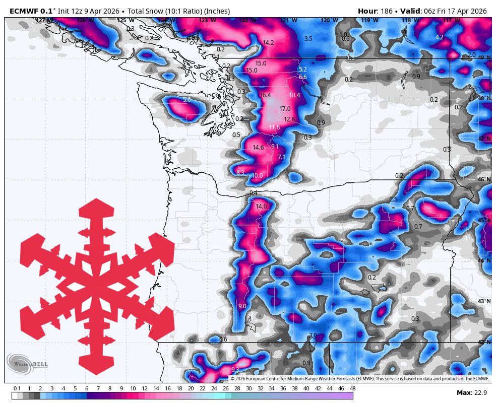
"The better storm arrives Tuesday and peaks Tuesday night into Wednesday before tapering through Thursday. Confidence is highest from Tuesday morning through Thursday night, when guidance is most tightly clustered on onset, cooling, and a widespread Cascade refresh."
"Snow levels fall to around 500-2,500 feet in Washington and Whistler and roughly 1,500-3,500 feet in Oregon during the colder core, while mountain temperatures settle into the 20s."
"That supports a realistic regional outcome of 10-20 inches at the favored northern Cascades and Mt. Hood, with 5-10 inches more likely at Whistler and Mt. Bachelor."
The Pacific Northwest will remain mild through the weekend, transitioning to colder conditions with new snow expected from Tuesday to Thursday. Early showers may not lead to significant accumulation, but a storm next week will lower snow levels, benefiting areas like Mt. Baker and Stevens Pass. Snow levels will initially be high, leading to mixed precipitation, but will drop significantly, allowing for better snowfall. The storm is expected to bring 10-20 inches of snow in favored areas, improving snow quality throughout the week.
Read at SnowBrains
Unable to calculate read time
Collection
[
|
...
]