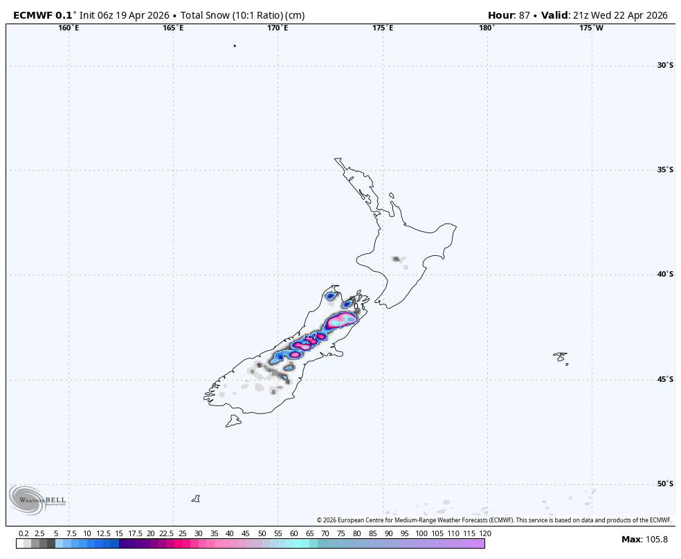
"The South Island is favored through Thursday morning, with Canterbury's higher terrain expecting 50-80 cm of snow, while the North Island will have lighter, denser upper-mountain snow."
"Models agree on the storm structure and colder air lowering snow levels quickly in the south, but uncertainty remains regarding the intensity of Wednesday's pulses at exposed eastern fields."
"Snow levels will fall from 1,300-1,500 meters early Monday to around 700-1,000 meters by Monday night, supporting strong confidence in continued base building."
"The North Island pulse will occur mainly from Tuesday into early Thursday, with models diverging on snowfall totals but converging on strong winds and marginal snow levels."
An early-week storm will bring heavy snow to the South Island, particularly in Canterbury, with 50-80 cm expected. Snow levels will drop quickly due to colder air. The North Island will see lighter snowfall with higher snow levels. The storm's strongest impact will occur Monday and Tuesday, tapering off by Wednesday. Snow quality will improve as temperatures drop, with denser snow transitioning to a more workable consistency. Strong winds will accompany the storm, especially in the North Island, affecting skiing conditions.
Read at SnowBrains
Unable to calculate read time
Collection
[
|
...
]