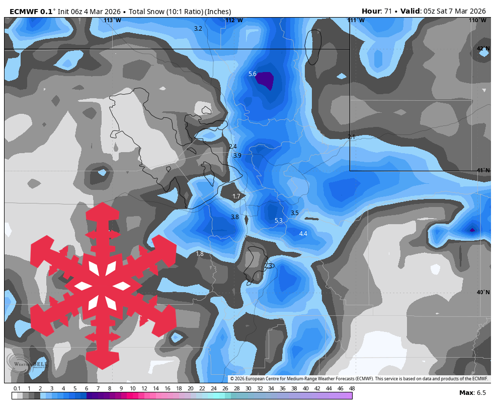
"Wednesday stays dry and relatively mild, then snow spreads in from north to south late Wednesday night and ramps up Thursday. For this first storm, guidance is converging on arrival and exit timing and on a falling snow level trend, but diverging on intensity, especially in the Wasatch where one solution is much drier than the rest."
"Snow levels during active precipitation start around 6,500 to 8,000 feet, then drop to roughly 3,000 to 5,000 feet by Thursday night and Friday, so lower bases can start mixed before turning to snow. Snow quality should be mostly moderate to light, with SLRs largely 10-17 and occasional denser 8-10 periods early."
"By Friday night, favored northern totals are generally 10″-14″, Park City side around 5″-8″, and Eagle Point near 4″-6″. Snow showers fade Friday afternoon into Friday night, and guidance then converges strongly on a quieter Saturday through Monday."
Utah will experience a meaningful winter storm from late Wednesday night through Friday, with snow spreading north to south and intensifying Thursday. Northern and central mountain ranges will receive the best accumulation, with northern totals around 10-14 inches, while southern Utah will still see useful coverage. Snow levels will drop from 6,500-8,000 feet to 3,000-5,000 feet by Friday, with moderate to light snow quality and wind gusts of 30-45 mph creating visibility reductions. Following the storm, conditions stabilize Saturday through Monday with dry weather, lighter winds, and temperatures rising into the 30s and low 40s. Confidence decreases significantly for systems arriving Tuesday and beyond due to greater timing and intensity uncertainty.
Read at SnowBrains
Unable to calculate read time
Collection
[
|
...
]