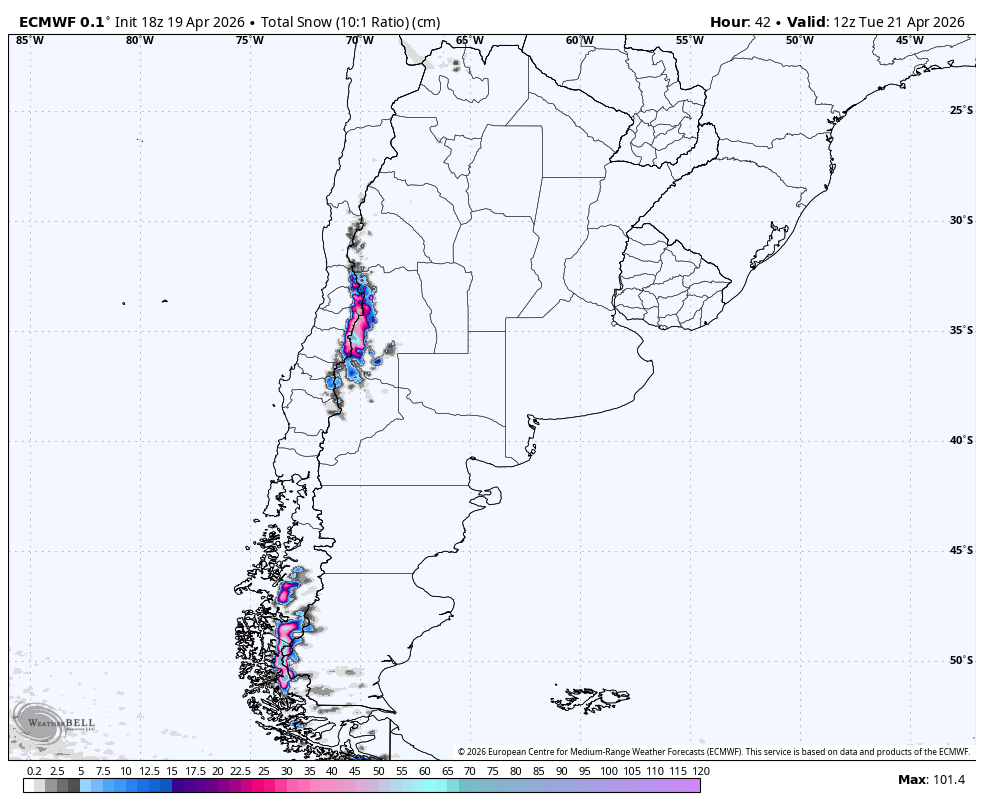
"The ongoing Sunday night into Monday storm across the central Andes keeps producing mainly upper-mountain snow through Monday before tapering out by Tuesday morning, April 21. A realistic near-term outcome is about 16-20 cm at Las Leñas, 9-11 cm at Valle Nevado, and lighter 5-8 cm amounts around El Colorado, La Parva, and Portillo."
"Snow levels stay high, mostly around 2,400-3,000 meters in central Chile and closer to 1,700-2,600 meters at Las Leñas, so this is mostly dense to fair snow with SLRs near 6-10, improving toward 10-14 late at Las Leñas as colder air filters in."
"After that wave exits, much of the range settles down for a couple of drier days before activity starts rebuilding from the southern Andes later in the week. From Friday through Sunday, April 24-26, the guidance converges on a colder, more persistent pattern for Cerro Castor, Chapelco, Cerro Catedral, and Corralco."
A storm affecting the central Andes will produce upper-mountain snow through Monday, tapering off by Tuesday morning. Snow totals are expected to be 16-20 cm at Las Leñas and lighter amounts at other resorts. Snow levels will remain high, resulting in dense snow. After a brief dry period, a more active weather pattern is anticipated from Friday through Sunday, April 24-26, particularly in the southern Andes, with colder conditions expected.
Read at SnowBrains
Unable to calculate read time
Collection
[
|
...
]