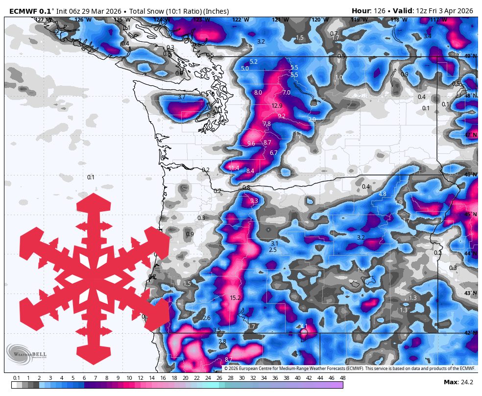
"The biggest totals in the most reliable part of the forecast look centered on Timberline and Mt. Bachelor at 12"-20", with Mt. Baker and Stevens next in line."
"Monday and Tuesday look like the cleanest stretch of the forecast, with dry breaks, cold mornings, and decent spring skiing between storms."
"Snow levels run roughly 2,500 to 3,500 feet in Washington and British Columbia and closer to 4,000 to 6,000 feet in Oregon before dropping overnight."
The week will be shaped by two weather systems, starting with a light refresh on Sunday followed by a stronger storm midweek. The best snow accumulation is anticipated from Wednesday into early Friday, particularly favoring Timberline and Mt. Bachelor with totals of 12"-20". Snow levels will drop overnight, affecting areas in Washington and Oregon differently. Monday and Tuesday will be dry and cold, providing good skiing conditions before the next storm arrives midweek, which will bring significant snowfall and colder temperatures.
Read at SnowBrains
Unable to calculate read time
Collection
[
|
...
]