"Confidence is highest from Tuesday evening through Saturday midday, when guidance is closely aligned on the cooling trend, two rounds of mountain snow, and periodic ridge-top gusts before most solutions turn quieter and milder again later Sunday through next week."
"Snow levels generally start around 9,000-10,000 feet, then settle toward 7,500-9,000 feet as colder air works in, so lower bases can start wet while higher terrain stacks snow more efficiently."
"A colder second wave should arrive late Thursday night, peak Friday into early Saturday, and bring the best snow quality of the stretch. Guidance still converges on the timing and colder air, but it diverges more on exact placement and intensity."
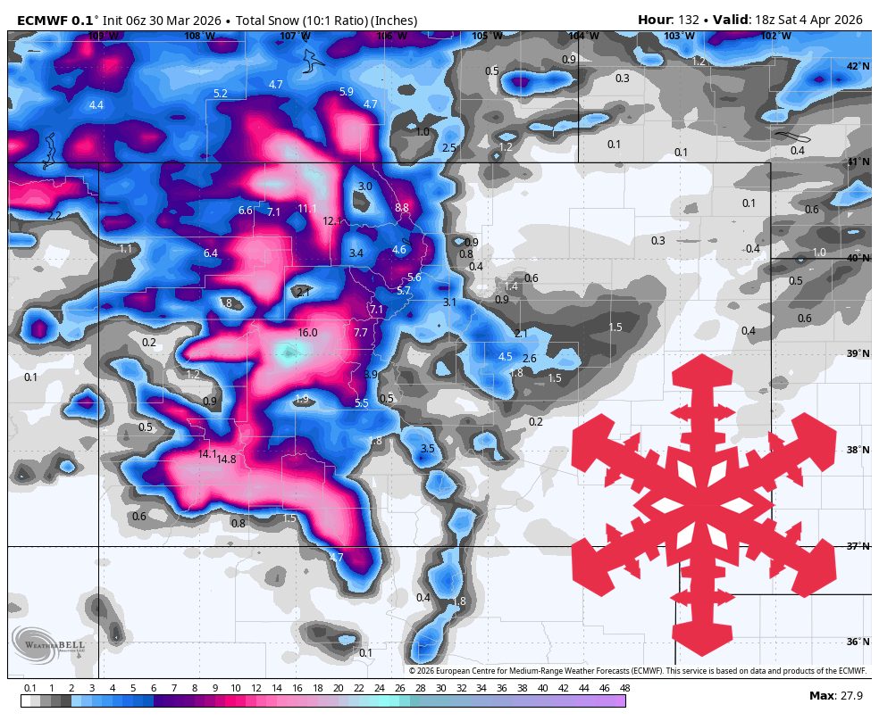
Two spring systems will bring mountain snow to Colorado, particularly favoring the San Juans. A warm and breezy Monday will precede a cooling trend starting Tuesday evening. The first wave of snow will arrive Tuesday night, with snow levels dropping to 7,500-9,000 feet. The San Juans may see 12-24 inches, while northern and central mountains could receive 3-10 inches. A second wave late Thursday will bring lighter snow with improved snow quality. After Saturday, conditions will become quieter and milder into the following week.
Read at SnowBrains
Unable to calculate read time
Collection
[
|
...
]