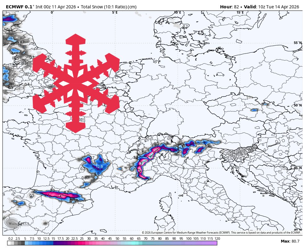
"From Sunday afternoon, April 12, through Tuesday, April 14, the guidance is most consistent, and this is the period to trust for specific snowfall and timing."
"Cervinia and Zermatt are best positioned for 20-30 cm, Val d'Isère looks closer to 10-15 cm, and Verbier, Val Thorens, and Tignes are more in the 5-10 cm zone."
"Snow levels start high, around 2,400-2,600 meters, then fall toward 1,800-2,000 meters late Monday into Tuesday, so lower villages remain vulnerable to rain or wet snow."
The European Alps will remain mostly quiet until Sunday afternoon, when snowfall will increase, especially near the Swiss-Italian border. From April 12 to April 14, snow levels will drop from 2,400-2,600 meters to 1,800-2,000 meters. Cervinia and Zermatt are expected to receive 20-30 cm of snow, while Val d'Isère may see 10-15 cm. Wind impacts will be light, making this forecast more about snow levels and placement rather than wind events. After Tuesday, conditions will quiet down again.
Read at SnowBrains
Unable to calculate read time
Collection
[
|
...
]