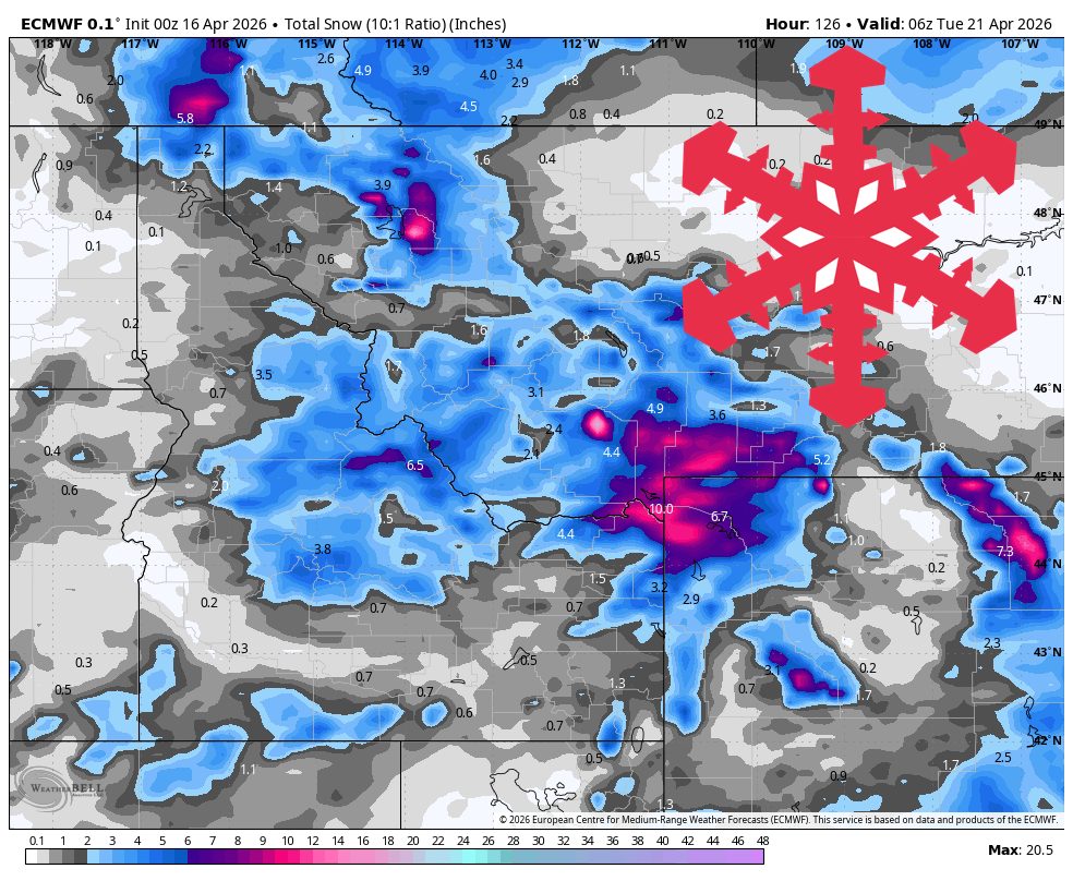
"The steadiest snow and best odds for a meaningful refresh sit in western Wyoming and southwest Montana, where totals reach 5-12 inches, while Idaho areas mostly see 1-3 inches."
"Saturday through Monday looks much quieter, and the models are tightly converged on a ridge bringing dry weather, lighter winds, and a sharp rebound in temperatures."
"After cold starts in the teens and 20s Saturday morning, many resort temperatures climb back into the 40s Saturday and into the 50s by Sunday and Monday."
A cold storm affects the Northern Rockies, delivering 5-12 inches of snow in western Wyoming and southwest Montana, while Idaho sees 1-3 inches. Snow levels drop to valley floors, with gusts of 30-40 mph. The storm continues through Friday night, tapering off late. A dry ridge will bring warmer temperatures and sunnier conditions from Saturday to Monday, with temperatures rising into the 40s and 50s. Grand Targhee will maintain winter conditions, while other areas transition to spring-like weather.
Read at SnowBrains
Unable to calculate read time
Collection
[
|
...
]