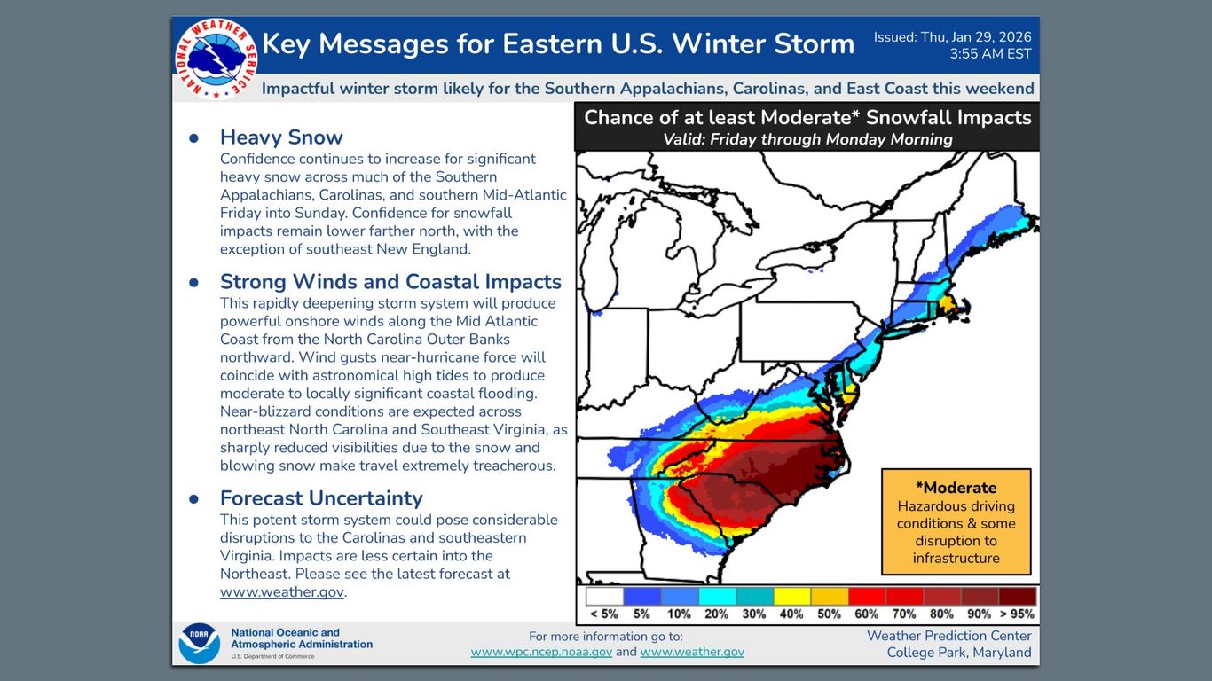
""By Friday evening into Saturday, the snow will move into the southern Mid-Atlantic and rain over the Southeast." NWS continues: "This rapidly deepening storm system will produce powerful onshore winds along the Mid-Atlantic Coast from the North Carolina Outer Banks northward." "Wind gusts nearhurricane-force will coincide with astronomical high tides, producing moderate to locally significant coastal flooding." NWS also warns of "near-blizzard conditions ... across northeastern North Carolina and Southeastern Virginia.""
""By the numbers: About 22.5 million Americans are under winter storm watch as of Thursday morning, mostly in the Carolinas and southern Virginia. As much as a foot of snow is possible along the North Carolina coast, with smaller amounts predicted inland. Zoom in: NWS forecasters in North Carolina are currently predicting around 8 inches in Raleigh - but they warn the setup presents \"an incredibly difficult forecast challenge.\""
A rapidly deepening coastal storm will move snow into the southern Mid-Atlantic by Friday evening into Saturday while producing rain across the Southeast. Powerful onshore winds from the North Carolina Outer Banks northward will generate near-hurricane-force gusts that could coincide with astronomical high tides, causing moderate to locally significant coastal flooding. Near-blizzard conditions are possible across northeastern North Carolina and southeastern Virginia. About 22.5 million people are under winter storm watch, with up to a foot possible along the North Carolina coast and roughly eight inches forecast for Raleigh. Small track shifts could greatly change snowfall amounts for cities up the Eastern Seaboard, so forecasts remain highly uncertain.
Read at Axios
Unable to calculate read time
Collection
[
|
...
]