#storm-related-flight-disruption
#storm-related-flight-disruption
[ follow ]
#flight-cancellations #winter-storm #power-outages #flooding #severe-weather #travel-disruption #storm-dave


fromABC7 Chicago
6 days agoSevere storms accompanied by tornadoes damage communities from the Plains to the Midwest
Authorities in Kansas reported several people with minor injuries after storms passed through on Monday. Three people were left with minor injuries in rural Franklin County, about 50 miles southwest of Kansas City.
Canada news
fromThe Washington Post
4 weeks agoRare Middle East storm could bring floods, damaging winds and tornadoes
Parts of the Arabian Peninsula and Persian Gulf could be slammed by strong to severe thunderstorms Thursday, bringing the potential for damaging winds, destructive hail and a few tornadoes.
World news
NYC parents
fromNews 12 - Default
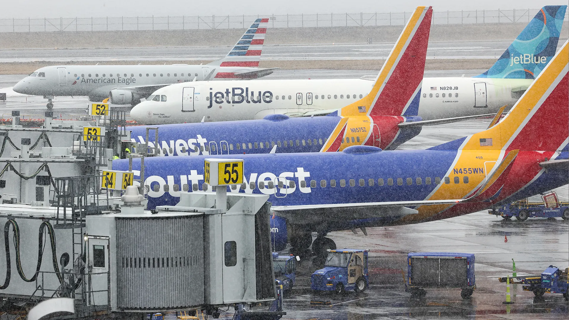
1 month agoDense fog causes hundreds of flight delays and cancellations across NYC airports
Dense fog across NYC airports Monday caused hundreds of flight delays and cancellations, with visibility dropping below a quarter mile and conditions expected to persist through early Tuesday.
Europe news
fromIrish Independent
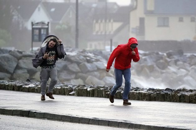
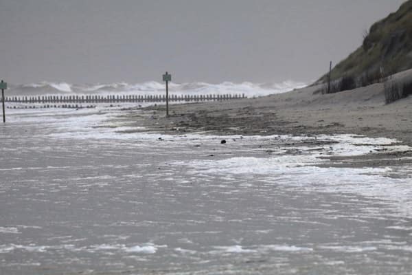
2 weeks agoWorst of Storm Dave weather has passed as thousands of homes without power; warning of potential flight disruption today
Dublin Airport experienced flight disruptions due to strong winds, while Howth RNLI rescued a kite surfer blown offshore during Storm Dave.
#winter-storm

US news
fromwww.theguardian.com
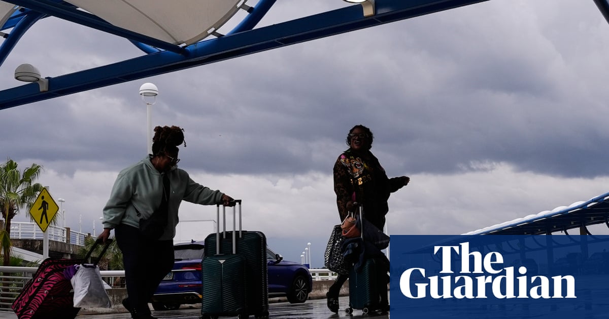
1 month agoThousands of flights canceled as winter storm marches across US
A late winter storm across the eastern US caused thousands of flight cancellations and delays, affecting over 200 million people with severe weather ranging from blizzards to tornadoes and record heat.


Europe news
fromIrish Independent
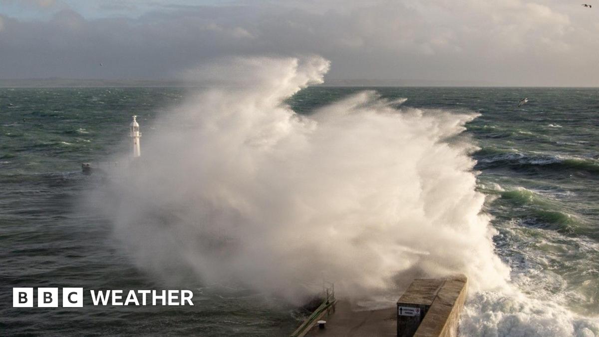
2 weeks agoStorm Dave: flights cancelled at Dublin Airport as warning comes into force for entire country with 100kmh gusts expected
Storm Dave is causing significant travel disruptions in Ireland with wind and rain warnings, leading to flight cancellations and challenging driving conditions.
fromMail Online
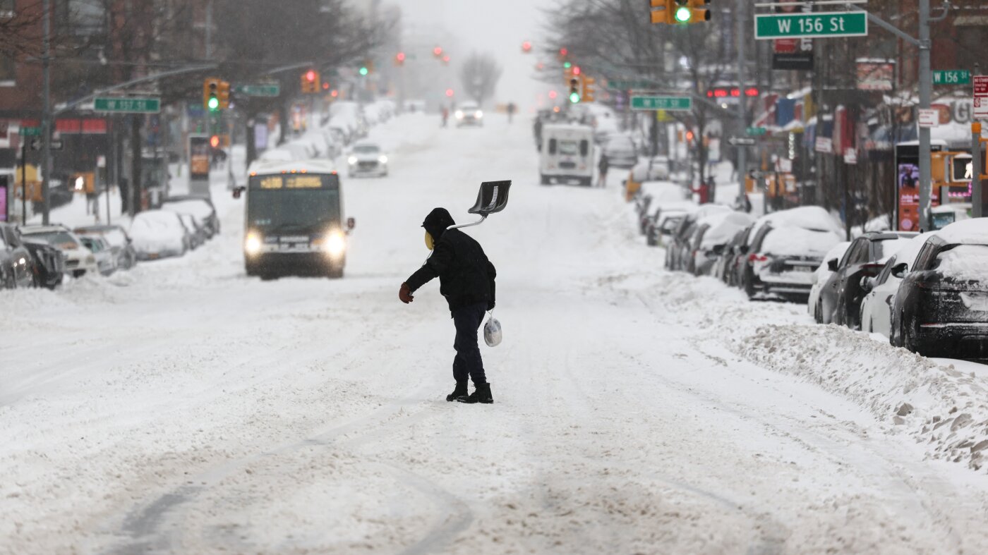
1 month agoHazardous weather alert for 200 million as megastorm barrels across US
The storm from Sunday into Monday has the potential to become a bomb cyclone, which occurs when central pressure drops at least 0.71 inches of mercury (24 millibars) in 24 hours or less. That rapid strengthening would generate an expansive and intense wind field.
Chicago
UK news
fromLondon Business News | Londonlovesbusiness.com
1 month agoMet Office advises strong winds could cause travel disruption across UK - London Business News | Londonlovesbusiness.com
The Met Office issued yellow wind warnings across the UK with gusts up to 70 mph, causing travel disruptions and potential power outages.
fromIrish Independent
1 month agoFlights to Dublin cancelled as Storm Hernando closes in on US east coast
Posting on X, the airport said: "Due to adverse weather (Storm Hernando) on the east coast of the US, airlines have cancelled a number of flights due to operate to/from Dublin Airport on Monday." We need your consent to load this Social Media content. We use a number of different Social Media outlets to manage extra content that can set cookies on your device and collect data about your activity. Please review your details and accept them to load the content
Travel
fromIrish Independent
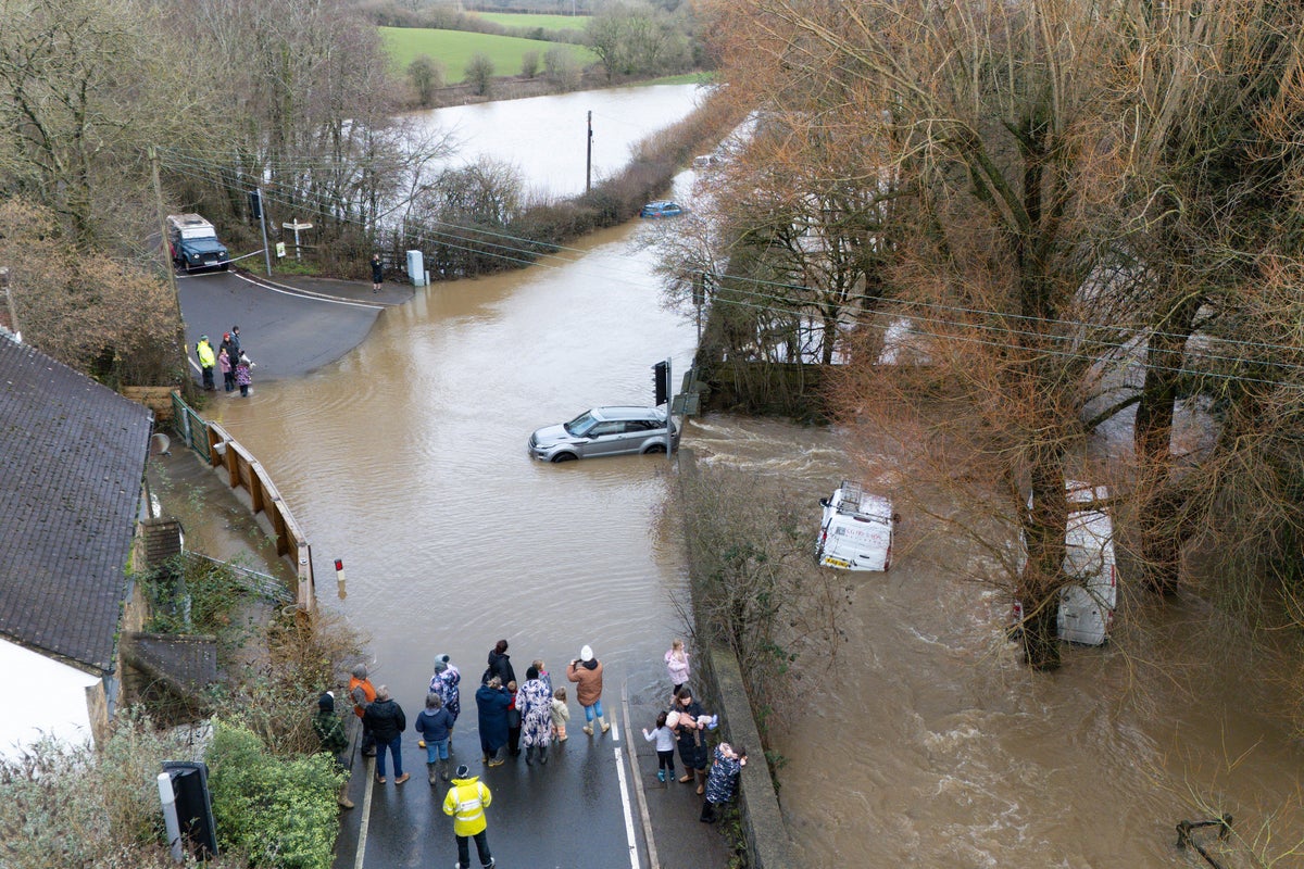
2 months agoMet Eireann issues snow, wind and rain warnings for 12 counties with more flooding and disruption forecast
Wexford, Wicklow, Dublin, Meath and Louth will be under a Status Yellow wind warning and Met Éireann are warning of fallen trees and loose debris, as well as difficult travelling conditions associated with this warning. Counties Cork, Waterford, Carlow, Kilkenny, Wexford, Wicklow, and Dublin will be under also be under a Status Yellow rain warning and these counties can expect flooding, poor visibility and difficult travel conditions for the 24-hour period.
Miscellaneous
fromIrish Independent
2 months agoDublin Airport warns passengers of disruption as US winter storm hits transatlantic flights
The monster winter storm is expected to converge with bitter Arctic cold and engulf much of the US this weekend from the Rockies to the eastern seaboard. Forecasters are expecting heavy snow, sleet and freezing rain, accompanied by dangerously frigid temperatures, to sweep the eastern two-thirds of the nation, threatening to upend travel and spawn widespread power outages. Snow has already fallen over parts of Texas, Oklahoma and Kansas in a frosty prelude to the winter storm.
Environment
fromIrish Independent
2 months agoMet Eireann changes Orange and Yellow rain warnings as flood threat peaks and travel disruption hits
The threat of flooding is set to peak this morning, with road networks expected to bear the brunt of the deluge. However, damage to residential and commercial properties is also likely, emergency services have warned. With Dublin, Louth, Waterford and Wexford under Status Orange rain warnings, people in those counties have been urged to work from home in order to keep the roads clear for emergency vehicles.
Miscellaneous


fromIrish Independent
2 months agoSevere flooding disruption as forecasters issue last-minute rain warning; winter to bite hard as ice, frost and snow due in coming days
"It will prove cold with some frost and ice in places on Friday morning, especially in the west and north," she said. "Munster and south Leinster will see cloud, but that will clear to leave dry and sunny conditions with a few isolated showers in the north and highest temperatures of 3C to 7C," she said. Friday night will prove mainly dry but very cold and frosty with some icy patches.
Environment
fromMail Online
2 months agoNationwide travel chaos as hurricane-force winds rip through US
Extreme winds ripping across the US could bring hurricane levels of destruction and impact thousands of air travelers flying across the country. The National Weather Service (NWS) has issued high wind warnings throughout more than 10 states in the Rocky Mountains, Great Plains, and Southwest throughout Tuesday. Wind gusts are expected to reach hurricane strength in parts of Colorado, Montana, Texas, New Mexico, and Wyoming, exceeding 75mph.
US news
fromwww.theguardian.com
2 months agoWeather tracker: Spain and Portugal hit by third fatal storm
Spain and Portugal have endured another storm over the weekend, just days after the deadly flooding and major damage caused by Storm Kristin and Storm Leonardo last week. Storm Marta passed over the Iberian peninsula on Saturday bringing fresh torrential rain, killing two people. Storm Kristin killed at least five people when it swept through Portugal last week with Storm Leonardo claiming another victim last Wednesday.
Environment
US news
fromCN Traveller
1 month agoWinter Storm Hernando grounds thousands of flights - what passengers need to know about US travel right now
Widespread travel bans and a winter storm have grounded thousands of flights, halted major hubs, and prompted airlines to issue rebooking waivers and cancellations.
[ Load more ]