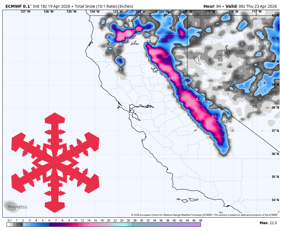
"California's Sierra region is set to experience a storm from early Tuesday through Wednesday evening, with forecasts indicating 1-2 feet of snow on favored higher terrain. Windy conditions will precede the storm on Monday, with snow beginning before dawn on Tuesday and intensifying throughout the day."
"Snow levels are expected to start between 6,500-7,500 feet, leading to mixed conditions at lower elevations initially. However, as colder air moves in Tuesday night, conditions will improve significantly, with snow levels dropping to around 4,500-6,500 feet by Wednesday."
"The storm's intensity guidance suggests that Kirkwood, Bear Valley, Dodge Ridge, Sugar Bowl, and Palisades Tahoe will likely receive the best snow accumulation, while lower Tahoe bases may see wetter snow initially before transitioning to better conditions."
A Sierra storm will impact California from early Tuesday through Wednesday evening, bringing 1-2 feet of snow to higher elevations. Windy conditions are expected on Monday, with snow beginning before dawn on Tuesday. Snow levels will start high but will lower significantly by Wednesday, improving conditions for skiing. The best snow accumulation is anticipated at higher elevations, while lower Tahoe bases may experience mixed conditions initially. Snow quality is expected to improve significantly Tuesday night into Wednesday, with confidence in snowfall amounts increasing.
Read at SnowBrains
Unable to calculate read time
Collection
[
|
...
]