#national-hurricane-center
#national-hurricane-center
[ follow ]
fromABC13 Houston
3 weeks agoNational Hurricane Center updates forecast products ahead of 2026 season
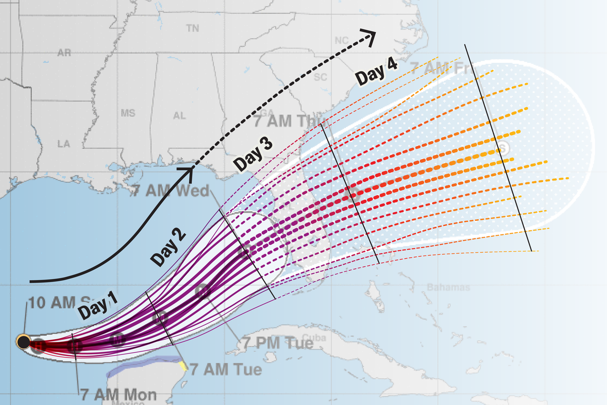
"We're moving to what's called the 90th percentile, meaning the center should only move outside that cone one tenth of the time, or 10% of the time. So there's less of a chance that the center will move outside of that new experimental cone."
Environment
fromFast Company
2 months agoThe National Hurricane Center's new forecast cone will warn more people if they're in the path of a storm. What you need to know
"These improvements empower communities to prepare earlier and more effectively for dangerous hazards from tropical storms and hurricanes," said Michael Brennan, director of NOAA's National Hurricane Center.
Environment

[ Load more ]