#coastal-low-pressure
#coastal-low-pressure
[ follow ]
#climate-change #bomb-cyclone #coastal-flooding #winter-storm #extreme-weather #storm-surge #natural-disasters
#hurricane-preparedness
Environment
fromFast Company
4 weeks agoThe National Hurricane Center's new forecast cone will warn more people if they're in the path of a storm. What you need to know
NOAA's National Hurricane Center is redesigning its cone graphic for 2026 to enhance storm preparedness across the continental U.S., Hawaii, and territories.
fromLondon Business News | Londonlovesbusiness.com
1 day agoHigh pressure brings settled spell to UK with sunshine by day, frost by night - London Business News | Londonlovesbusiness.com
High pressure will remain broadly in charge of the UK's weather for the remainder of this week and into the weekend. Most places will remain dry with a fair amount of sunshine too.
Europe news


#bomb-cyclone
Chicago
fromMail Online
1 month agoHazardous weather alert for 200 million as megastorm barrels across US
A powerful megastorm will sweep across the central US from Sunday to Monday, potentially becoming a bomb cyclone with blizzard conditions, severe thunderstorms, and widespread travel disruptions across major cities.
fromMail Online
1 month agoUrgent 1,000-mile tornado watch issued along East Coast
More than 35 million people from the Florida Panhandle through Georgia, the Carolinas, Virginia, Maryland, Washington DC, Delaware, eastern Pennsylvania, New Jersey and parts of New York are under tornado watches. The most dangerous period is expected from midday through early evening, with forecasters warning the peak tornado threat in the Mid-Atlantic could occur between about 2pm and 7pm ET.
Miami food
fromwww.npr.org
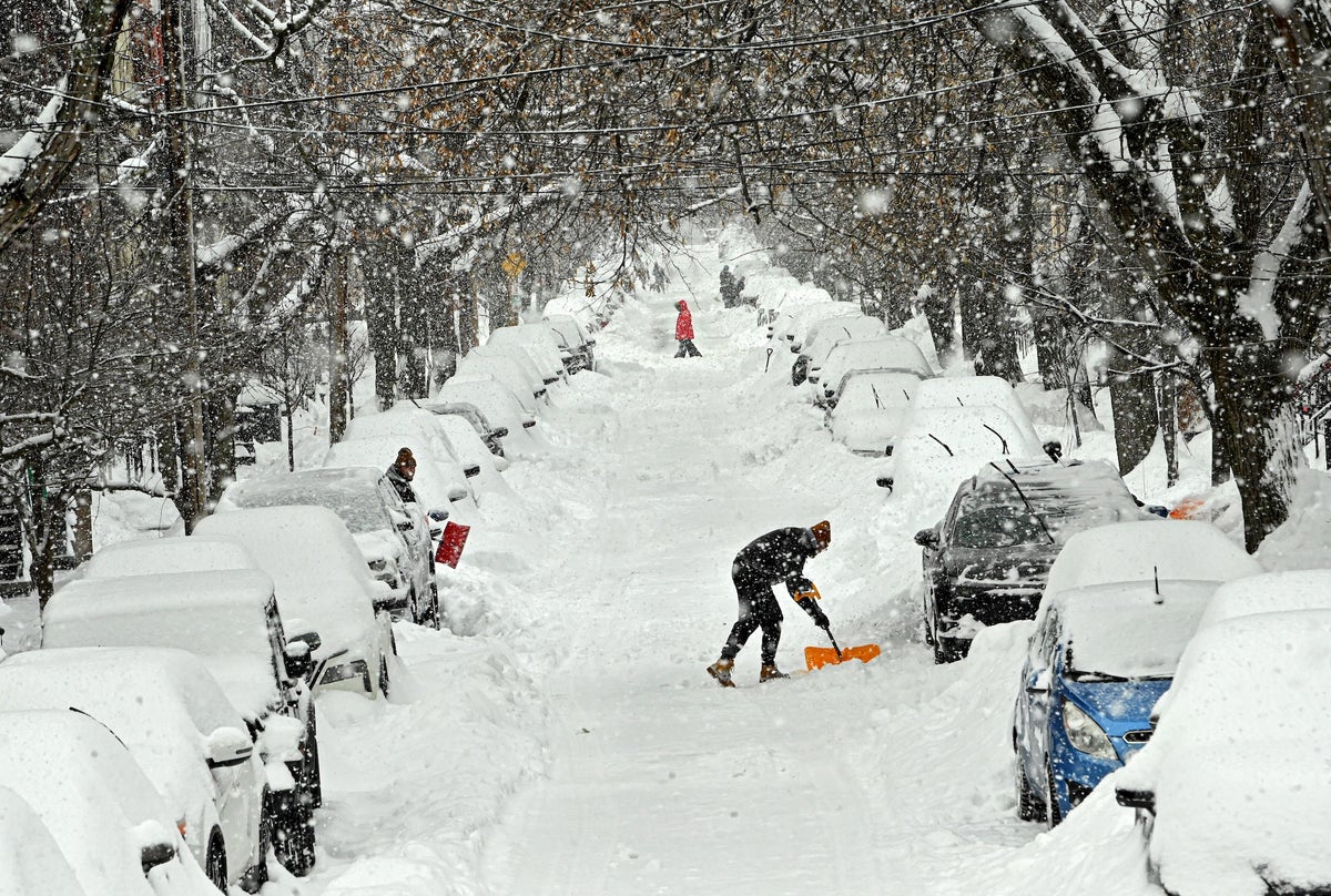
1 month agoSnow and wind batter parts of US, with threat of thunderstorms and tornadoes
Successive punches of snow, wind and severe weather are "going to impact the eastern half of the United States," AccuWeather senior meteorologist Tyler Roys said in an interview. Beyond the threat to lives and property, "whether it's wind gusts from a squall line, blizzard or snow, or just wind because of the storm, you're looking at several major airports being impacted."
US news

fromwww.theguardian.com
1 month agoA devastating force': how recent Mediterranean storms turned to tragedies
In Grazalema, Spain's wettest town, a year's-worth of rain fell in a fortnight and overloaded the karst aquifer beneath it. Water rushed into homes through floors, walls and even electricity sockets. Authorities ordered everyone to evacuate. I felt a lot of fear, said Sanchez Barea, a guesthouse owner whose home is one of hundreds still in an exclusion zone.
Miscellaneous
fromSilicon Canals
2 months agoThe one thing meteorologists wish people would stop doing before a winter storm hits - Silicon Canals
When I spoke with emergency management officials last year, they all mentioned the same frustrating scenario. People ignore storm warnings until the precipitation starts falling, then suddenly everyone rushes out at once. The roads become congested with anxious drivers, accidents spike, and stores run out of essentials just when people need them most. But here's what really gets meteorologists worked up about this pattern. Modern weather forecasting has become incredibly accurate, especially for major winter storms.
Public health


fromwww.npr.org
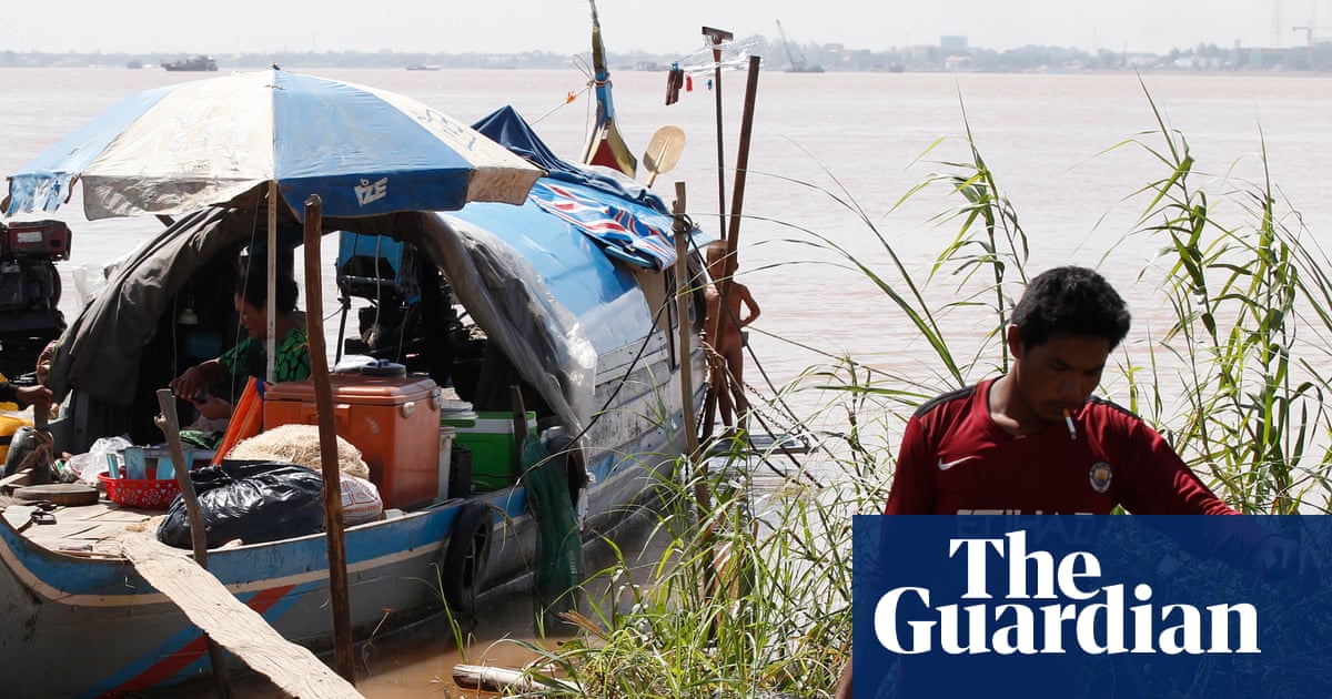
2 months ago'Please inform your friends': The quest to make weather warnings universal
In November 2025, a massive storm rolled across the lower Mekong River delta, dumping multiple inches of rain onto the wide, flat river plain that covers much of Cambodia. The river rose and rose. The force of the water churned up mud from the river bottom. The muddy water flowed downstream and rushed into the many farming and fishing towns that line the Mekong's banks.
US news
fromwww.scientificamerican.com
2 months agoWinter's next wallop includes a bomb cyclone and Florida freezing
Intensely cold air is scouring the central and eastern U.S. again and will send temperatures plummeting all the way to the tip of Florida. Along with this new Arctic incursion, a major bomb cyclone storm is strengthening off the coast of the Carolinas, potentially bringing rare blizzard conditions to the region. Some areas haven't seen this amount of accumulating snow in over 30 years, wrote the National Weather Service's office in Wilmington, N.C., on Facebook.
Science
fromIrish Independent
2 months agoMet Eireann issues snow, wind and rain warnings for 12 counties with more flooding and disruption forecast
Wexford, Wicklow, Dublin, Meath and Louth will be under a Status Yellow wind warning and Met Éireann are warning of fallen trees and loose debris, as well as difficult travelling conditions associated with this warning. Counties Cork, Waterford, Carlow, Kilkenny, Wexford, Wicklow, and Dublin will be under also be under a Status Yellow rain warning and these counties can expect flooding, poor visibility and difficult travel conditions for the 24-hour period.
Miscellaneous
Environment
fromFast Company
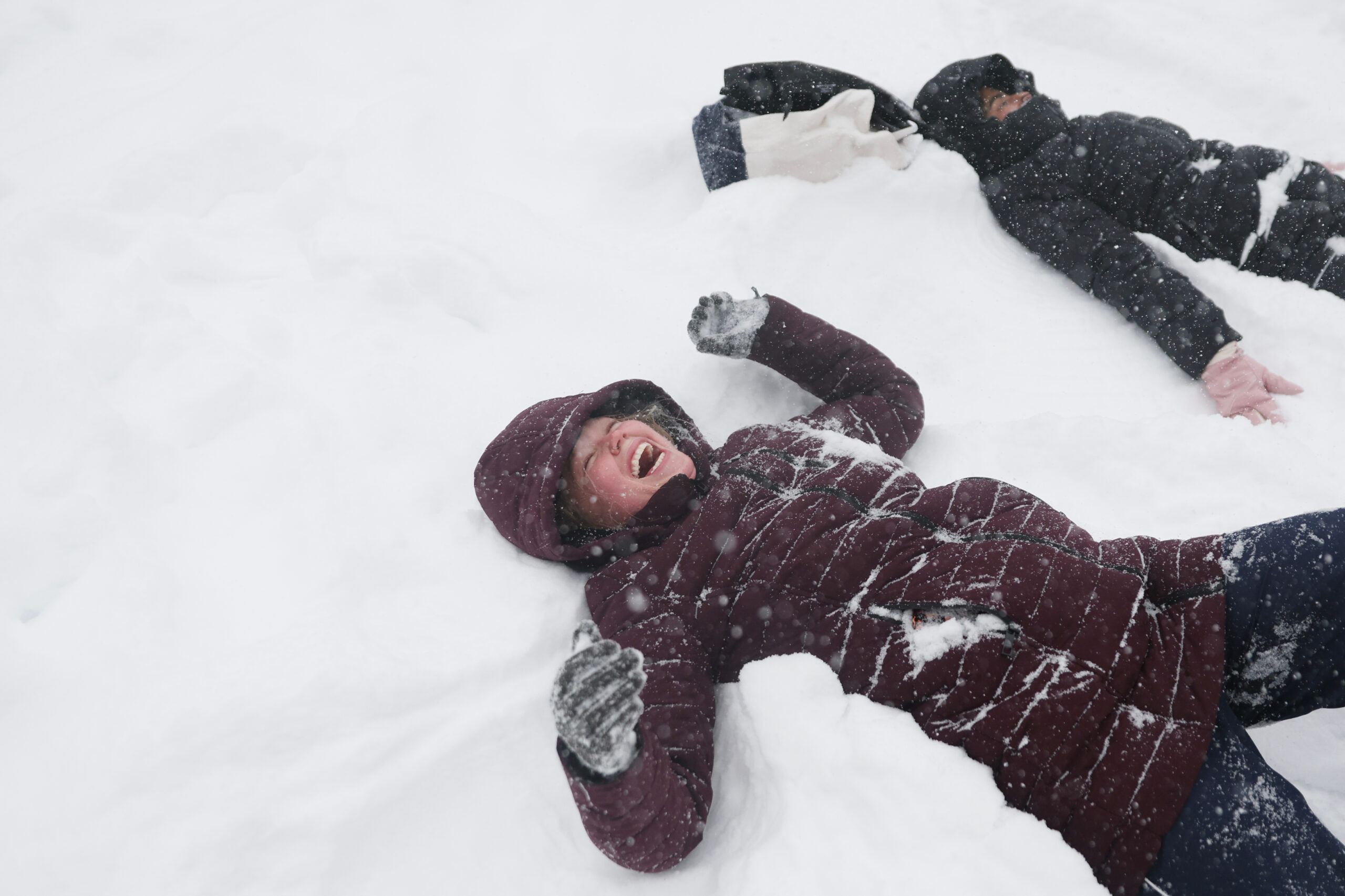
1 month agoWeather whiplash to sweep U.S. with simultaneous blizzard, polar vortex, and heat dome
Extreme weather is affecting nearly all U.S. regions simultaneously, including record heat in the Southwest, snow in the Great Lakes, Arctic cold in the Midwest and East, and heavy rain in Hawaii.
fromwww.scientificamerican.com
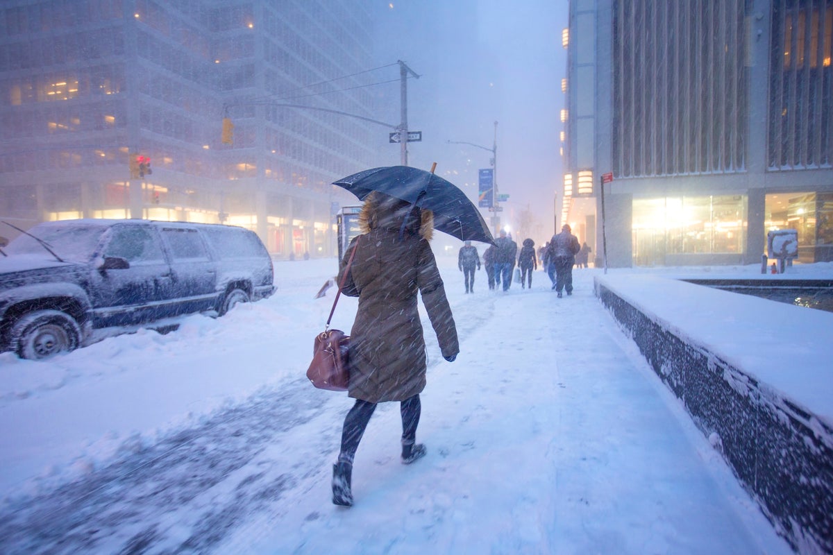
1 month agoA bomb cyclone is bringing blizzard conditions to the Northeast. So what is a blizzard exactly?
But what, exactly, is a blizzard? A blizzard doesn't always mean "a lot of snow," though it can certainly bring heavy snowfalls, as this storm is expected to along parts of the East Coast. Rather, the National Weather Service defines it as a snowstorm with winds regularly above 35 miles per hour and "considerable falling" or blowing snow for at least three hours.
Science
Environment
fromMail Online
1 month agoScientists find 'red flags' hinting the Gulf Stream is near collapse
The Atlantic Meridional Overturning Circulation shows warning signs of potential collapse due to freshwater from melting ice sheets diluting ocean water and weakening the system's driving mechanism.
fromwww.eastbaytimes.com
2 months agoBeach hazards statement for Bay Area Shorelines until Monday morning
Northern Monterey Bay and Southern Monterey Bay and Big Sur Coast as well as San Francisco County are under a beach hazards statement which was released by the National Weather Service on Thursday at 12:13 p.m. The statement is in effect until Monday Feb. 2, at 9 a.m. An increased risk of sneaker waves and strong rip currents with breaking waves of 14 to 19 feet, can be expected according to the NWS San Francisco CA.
Environment
fromLos Angeles Times
2 months agoStrong storm set to pummel L.A. with heavy rains, flooding and beach hazards
A powerful storm system arrives Sunday with heavy rain, thunderstorms and dangerous waves, posing threats of flooding and debris flows through early next week. The strongest impacts hit late Sunday through Monday, with 1-2 inches of rain expected in valleys and coasts, twice as much in mountains. High-surf advisory expected Monday through Thursday, with waves exceeding 10 feet across all Southern California beaches and a 20-30% chance of damaging sets midweek.
Environment
fromIrish Independent
2 months agoSevere flooding disruption as forecasters issue last-minute rain warning; winter to bite hard as ice, frost and snow due in coming days
"It will prove cold with some frost and ice in places on Friday morning, especially in the west and north," she said. "Munster and south Leinster will see cloud, but that will clear to leave dry and sunny conditions with a few isolated showers in the north and highest temperatures of 3C to 7C," she said. Friday night will prove mainly dry but very cold and frosty with some icy patches.
Environment
fromwww.eastbaytimes.com
2 months agoBeach hazards statement in place for Bay Area Shorelines until early Friday morning
Coastal North Bay including Point Reyes National Seashore, San Francisco Peninsula Coast, Northern Monterey Bay and Southern Monterey Bay and Big Sur Coast as well as San Francisco County are under a beach hazards statement which was released by the National Weather Service on Thursday at 8:22 p.m. The statement is in effect until Friday Feb. 6, at 4 a.m.
Environment
Environment
fromwww.eastbaytimes.com
2 months agoCoastal flood advisory issued for North Bay Interior Valleys and San Francisco Bay Shoreline until Sunday midday
Coastal flood advisory through Feb. 1 for North Bay Interior Valleys and San Francisco Bay Shoreline; up to 1.4 ft inundation and localized roadway flooding.
[ Load more ]