fromSnowBrains
3 months agoSnowboarding
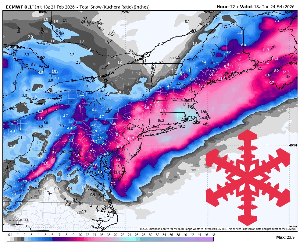
SnowBrains Forecast: 8 Inches for the Northeast This Weekend Ahead of a Stormier Pattern Next Week - SnowBrains
Coastal storm Monday brings heavy snow to southern New Hampshire and western Maine, with additional lake-effect and clipper snow in Michigan's Keweenaw.