Mobile UXfromZDNET1 month agoAndroid's emergency alerts just got a major map upgrade - but change this setting firstAndroid Wireless Emergency Alerts now feature a map showing affected areas and user locations for better situational awareness.
fromFast Company9 months agoPrivacy technologiesInstagram's new location sharing map: how it works and how to turn it off
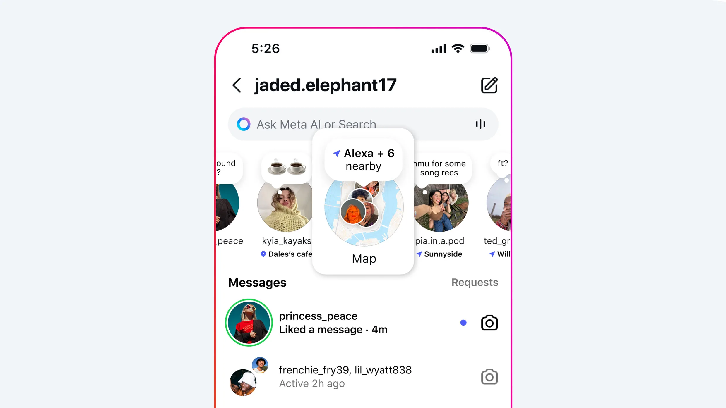
fromTechCrunch9 months agoSocial media marketingHow to use Instagram Map and set your location sharing preferences | TechCrunch
fromTechCrunch9 months agoDigital lifeInstagram takes on Snapchat with new 'Instagram Map' | TechCrunch
fromFast Company9 months agoPrivacy technologiesInstagram's new location sharing map: how it works and how to turn it off
fromTechCrunch9 months agoSocial media marketingHow to use Instagram Map and set your location sharing preferences | TechCrunch
fromTechCrunch9 months agoDigital lifeInstagram takes on Snapchat with new 'Instagram Map' | TechCrunch