California
fromKqed
1 hour agoBay Area Weather Turns the Corner With More Late Spring Rain | KQED
A storm is expected to increase Sierra Nevada snowpack, but drought concerns persist despite good reservoir conditions.
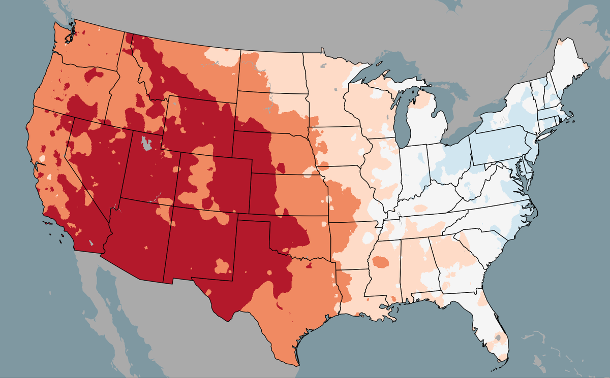
A fast-moving cold front is pushing south out of Canada, sending colder air across the Northeast and Mid-Atlantic, according to FOX Weather. More than 40 million people are expected to feel this 'winter flashback,' with temperatures running 10 to 20 degrees below average through midweek.
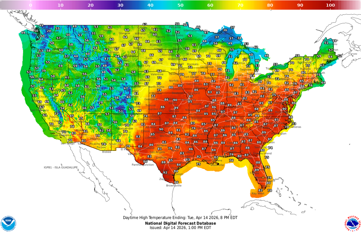
Kennedy predicts hot and dry conditions from the west will shift eastward later this week, allowing for a noticeable warm-up and shift towards spring-like conditions.
The tilt of the Earth's axis as it orbits around the sun causes seasons. Different parts of the world receive different amounts of sunlight depending on that angle. In the Northern Hemisphere, we experience winter from December to March, while the Southern Hemisphere soaks up the sun.
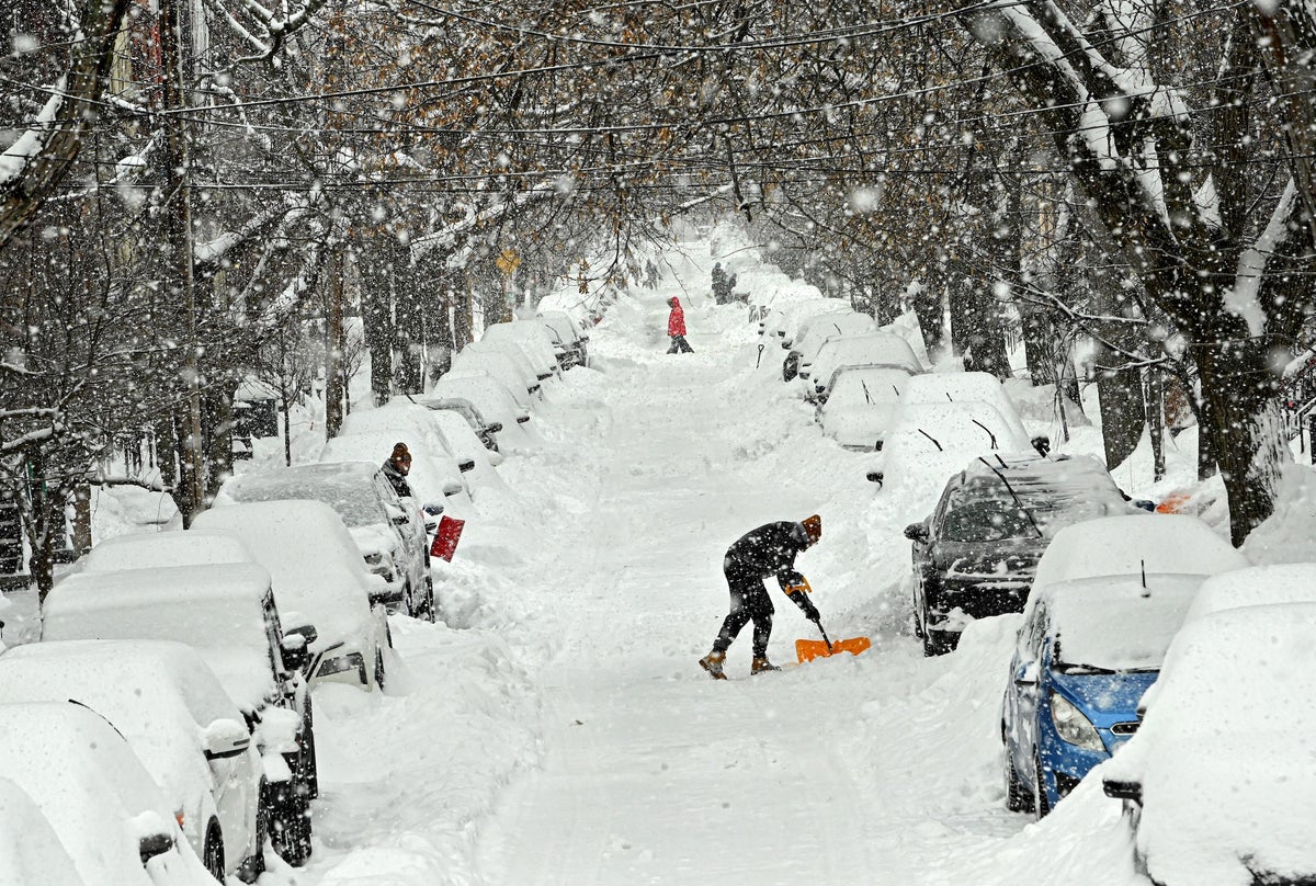
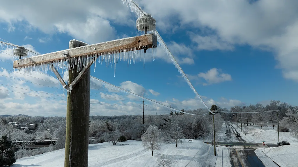
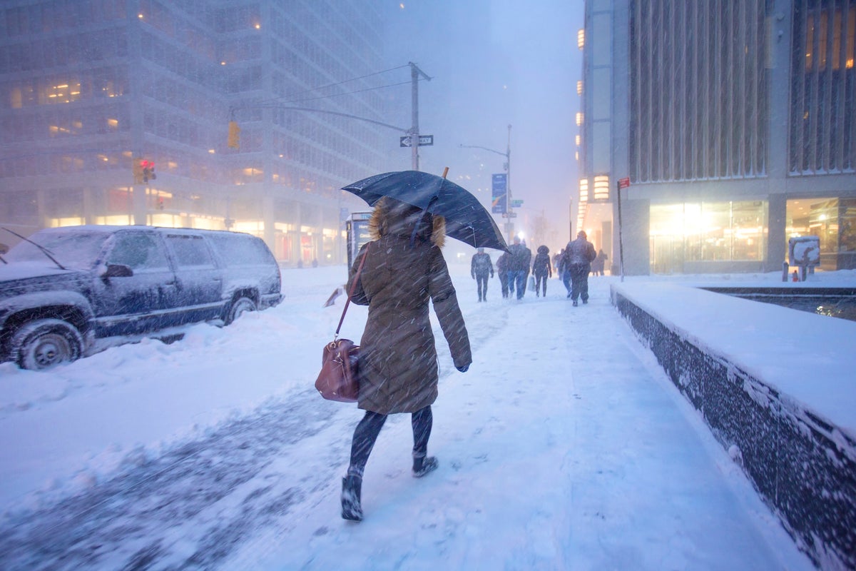
Intensely cold air is scouring the central and eastern U.S. again and will send temperatures plummeting all the way to the tip of Florida. Along with this new Arctic incursion, a major bomb cyclone storm is strengthening off the coast of the Carolinas, potentially bringing rare blizzard conditions to the region. Some areas haven't seen this amount of accumulating snow in over 30 years, wrote the National Weather Service's office in Wilmington, N.C., on Facebook.
An extraordinarily warm and mostly sunny January has left the snowpack across California's Sierra Nevada far smaller than usual - 59% of average for this time of year, state water officials announced Friday as they held the season's second snow survey. "We are now about halfway through the typically wettest part of the year," said Andy Reising, manager of snow surveys for the California Department of Water Resources.