#earth-imaging-satellites
#earth-imaging-satellites
[ follow ]
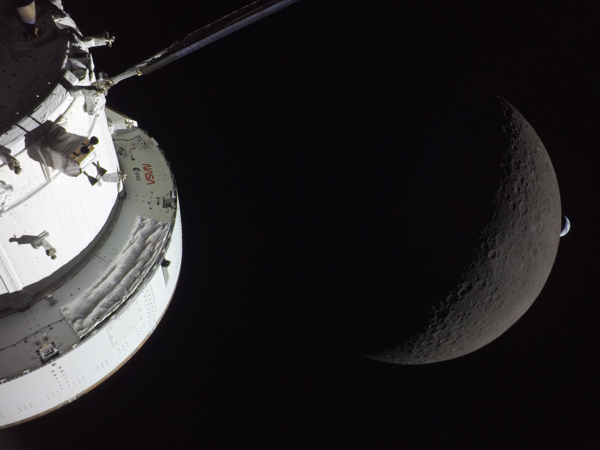
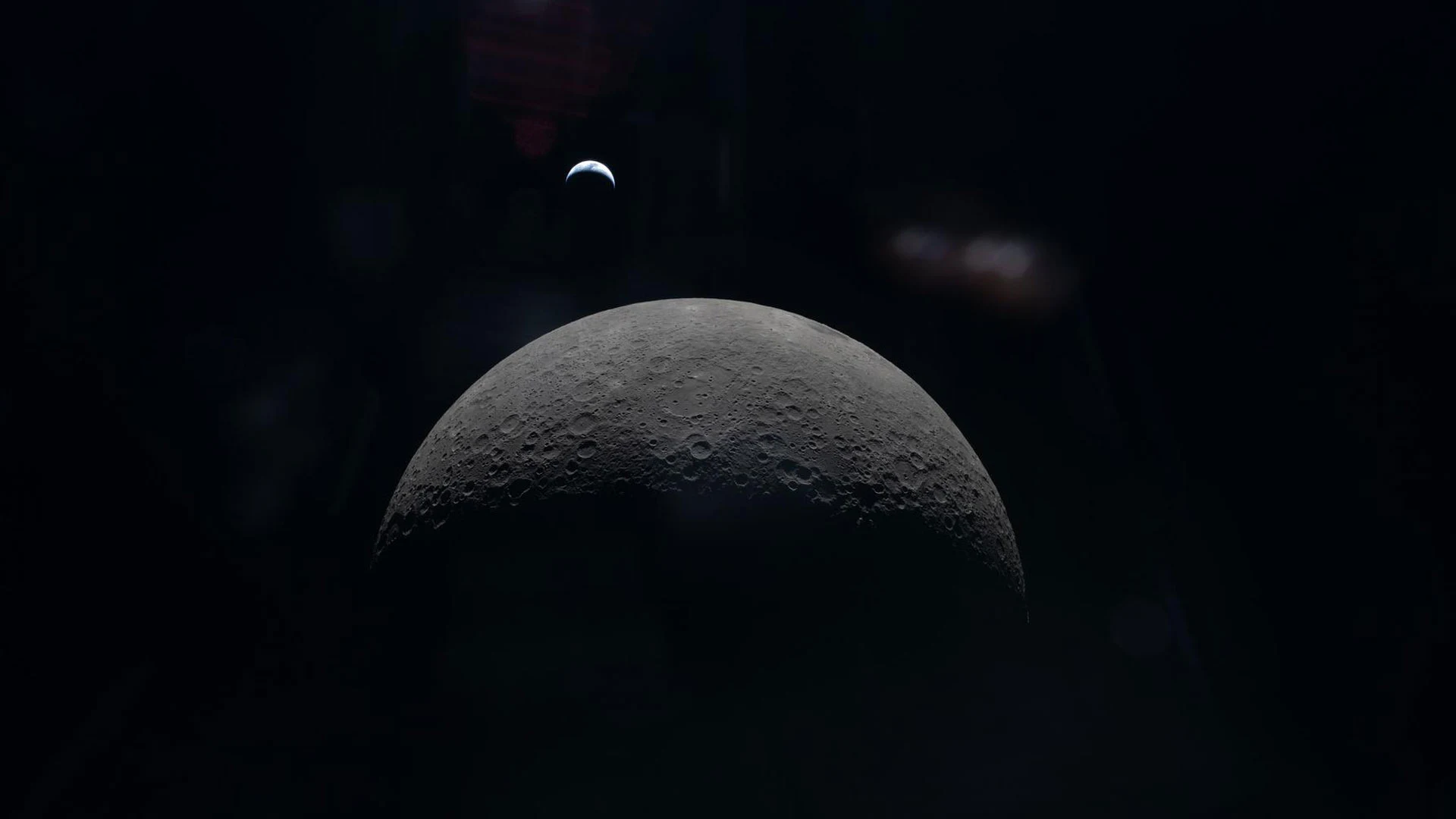
#nasa #artemis-ii #space-exploration #satellite-imagery #artificial-intelligence #light-pollution #space-debris


fromArchDaily
1 week agoMapping the Technosphere: Architecture as an Interface Between Systems and Territories
Architecture can no longer be conceived as an isolated object, detached from the technical networks that sustain contemporary life. This condition calls for new readings and approaches.
Design
#light-pollution
:max_bytes(150000):strip_icc()/TAL-stary-night-sky-STARGAZETHREAT0426--437972ea17864d428b20fa60ac8c64f0.jpg)
Europe news
fromenglish.elpais.com
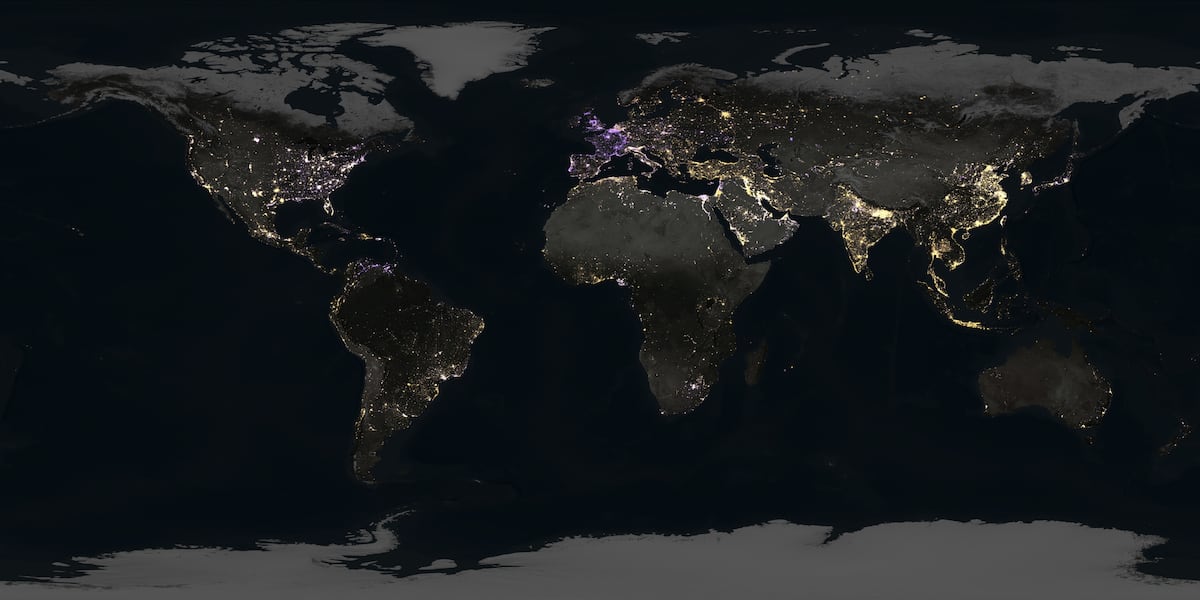
1 week agoFrom the nighttime lights of the rich to the blackouts caused by crises, this is how satellites capture the heartbeat of society'
Light pollution is increasing globally, but some regions are experiencing a decrease due to crises or effective environmental policies.

Business intelligence
fromLondon Business News | Londonlovesbusiness.com
3 weeks agoWhy GIS matters in modern infrastructure and urban planning: Building smarter, future-ready cities - London Business News | Londonlovesbusiness.com
GIS is essential for effective urban planning, enabling data-driven decisions that enhance infrastructure and quality of life in rapidly growing cities.
fromEarth911
3 weeks agoEarth911 Inspiration: The First Step To Sustainability
The first step to sustainability is seeing that there is no boundary between you and nature. When we see this essential connection and reverse the artificial disconnections created over millennia, people can imagine a future where we all thrive with a regenerated ecosystem.
Environment
fromRealagriculture
1 month agoTerraScout brings robot agronomic scouting to the farm
It can drive through the field and look at every square inch. We really honed our craft on model performance and detection with rocks, and now we've transitioned that into weeds. The robot uses a boom-mounted camera system to capture detailed imagery across the field. With eight cameras operating at 1 millimetre resolution, TerraScout can generate billions of data points per acre, allowing it to identify specific objects, including individual weeds.
Agriculture
fromFast Company
2 weeks agoSee it: Air temperatures and pollution around the world are captured in real time in these animated weather maps
We created Earth in Action to provide a lens into what's happening on our planet, as it happens. Whether it's something typical, like the current air temperature, or an extreme event like a major dust storm, we wanted to provide an opportunity for people to see them.
OMG science
Arts
fromThe Art Newspaper - International art news and events
1 month agoNew book shows why physical maps have an important role to play in our digital world
A cartography professor discovered 96 historically significant maps in a forgotten university archive, revealing cartography's vital role in preserving sociopolitical memory and demonstrating maps' importance beyond navigation.
fromNature
1 month agoObserving the tidal pulse of rivers from wide-swath satellite altimetry - Nature
Along coastlines, where tides are typically magnified, they profoundly affect navigation, commerce, coastal flooding, water properties and sediment transport. Tides impact the flooding of rivers and, thus, influence the extent of their floodplain, which has cascading effects on biogeochemical and ecological processes.
Environment
fromwww.dw.com
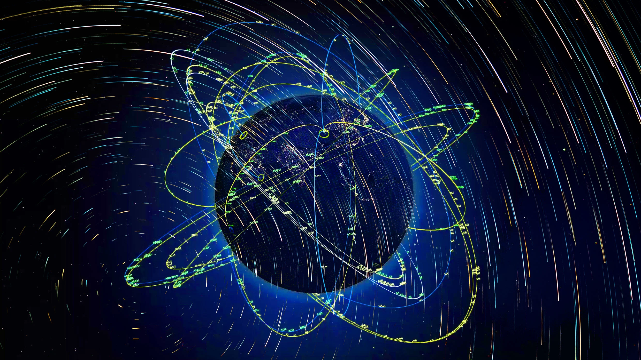
1 month ago'Vulnerable' satellites guide the world and its wars
Signals from Global Navigation Satellite Systems are quite vulnerable. They are exceptionally weak, meaning that any radio noise near their frequency, accidental or malicious, can interfere with reception. I am confident that there are people in every government who understand the problem. The challenge is getting leadership to both understand and act to reduce the risk.
European startups
fromTNW | Ecosystems
1 month agoAIRMO raises 5M to put methane-sniffing satellites in orbit by 2027
AIRMO secured €5 million seed funding to launch its first satellite in 2027, deploying micro-LiDAR and SWIR imaging technology capable of detecting methane leaks the size of a leaking car from orbit.
World news
fromThe Washington Post
1 month agoSatellite companies restrict access to Middle East imagery amid Iran war
Satellite imagery companies Planet Labs and Vantor voluntarily restricted access to Middle East images during U.S.-Israeli tensions with Iran to prevent adversarial targeting of allied personnel and civilians.

fromNature
2 months agoWhat my cave stay taught me about sensors
To capture the biological impact of this extreme environment, I used a comprehensive suite of sensors and biomarker analyses. I wore a wireless electroencephalograph (EEG) system to monitor brain activity, sleep stages and neural signatures of stress and adaptation; the Oura Ring to continuously track sleep patterns, heart-rate variability and circadian-rhythm shifts; and the glucose monitor to follow metabolic responses in real time.
Wearables
fromSnowBrains
2 months agoNASA: Satellite Image Shows Kamchatka, Russia, Buried by 19 Feet of Snow - SnowBrains
It has been an eventful few months for the Northern Hemisphere atmosphere. An unusually early sudden stratospheric warming episode in late November appears to have factored into a weakened and distorted polar vortex at times in December, likely causing extra waviness in the polar jet stream. This helped fuel extensive intrusions of frigid air into the mid-latitudes, contributing to cold snaps in North America, Europe, and Asia, and priming the atmosphere for disruptive winter storms in January.
Snowboarding
Gadgets
fromComputerWeekly.com
2 months agoMyriota introduces satellite-based scalable global asset tracking | Computer Weekly
AssetHawk combines native 5G NTN satellite connectivity with HyperPulse to deliver affordable, rapid-deploy satellite asset tracking for global visibility beyond cellular networks.
Agriculture
fromMedium
2 months agoLand Measurement App by Lumen Cluster: Measure Land Easily, Accurately, and Smartly
Smartphone-based Land Measurement App by Lumen Cluster enables fast, accurate, GPS-based land area calculations without specialized equipment, supporting multiple units for diverse users.
fromEngadget
1 month agoHow to send a message via satellite on iPhone
Apple's satellite features were originally designed for emergencies, allowing iPhone users to contact emergency services when cellular and Wi-Fi coverage is unavailable. With recent versions of iOS, Apple has expanded those capabilities to include sending and receiving messages via satellite. This makes it possible to stay in touch with friends and family from remote locations where traditional networks do not reach, such as hiking trails, rural areas or offshore locations.
Apple
#orbital-data-centers
Science
fromFuturism
1 month agoData Centers in Space Are Even More Cursed Than Previously Believed
SpaceX filed a patent for orbital data centers with up to one million satellites, but experts remain highly skeptical about financial feasibility and technological viability of space-based AI infrastructure.
Apple
fromNieman Lab
1 month agoThe team behind Dark Sky launches a weather app for uncertain, low-trust times
Acme Weather, from Dark Sky creators, displays forecast uncertainty through multiple prediction scenarios instead of single-point forecasts, acknowledging that weather predictions are inherently unreliable.
fromwww.scientificamerican.com
2 months agoHow new AI technology is helping detect and prevent wildfires
Wildfire prevention has traditionally relied on blunt tools, such as rigid inspection cycles and emergency power shutoffs. Now a new generation of technology start-ups is pitching a more targeted approach: using artificial intelligence to help utility companies decide what to inspectand where to intervenebefore a spark becomes a blaze. The stakes are rising. In 2025 more than 77,000 wildfires were reported in the U.S.significantly more than the past decade's averageand burned more than five million acres.
Environment
fromThe Cipher Brief
1 month agoGPS Denied: Time to Upgrade
On February 28, ships navigating the Strait of Hormuz started appearing on tracking screens in places they couldn't possibly be. They appeared to be sitting on airport runways, parked on Iranian land, and clustered at nuclear power plants. More than 1,100 commercial vessels had their navigation systems scrambled in a single day following US-Israeli airstrikes on Iran, bringing a waterway that handles a fifth of the world's oil exports to a halt.
Science
Environment
fromState of the Planet
2 months agoHarnessing AI, Scientists Discover a Rise in Floating Algae Across the Global Ocean
Floating algae blooms have increased globally since about 2008–2010, driven by warming oceans, changing currents, and nutrient pollution, with coastal ecological and economic harms.
fromTechCrunch
1 month agoGoogle is using old news reports and AI to predict flash floods | TechCrunch
While humans have assembled a lot of weather data, flash floods are too short-lived and localized to be measured comprehensively, the way the temperature or even river flows are monitored over time. That data gap means that deep learning models, which are increasingly capable of forecasting the weather, aren't able to predict flash floods.
Science
fromwww.scientificamerican.com
1 month agoDon't let mega-constellation-building billionaires steal your night sky
We are firmly in the era of the satellite constellation—groups of dozens of similar satellites—and are currently entering the era of the mega constellation, wherein groups of thousands of satellites swarm the skies. The clusters of satellites started small, but, like a viral outbreak, they grew almost without us noticing—and now we're dealing with a pandemic.
Science
fromArs Technica
2 months agoAs data from space spikes, an innovative ground station company seeks to cash in
By the end of the year, Northwood, based in El Segundo, California, had shown the ability to build eight of these Portal arrays a month. And in January the company had deployed operational Portal antennas across two continents. These deployments, which comprise an area of 8 to 15 meters, have the equivalent capability of a 7-meter parabolic dish, said Griffin Cleverly, co-founder and chief technical officer of Northwood.
Science
fromWIRED
1 month agoCould AI Data Centers Be Moved to Outer Space?
Now say you want to run some modest AI stuff. That's a bigger job, so let's scale up our cubical computer with edges twice as long as before. That would make the volume eight times larger (2 3), so we could have eight times as many processors, and we need eight times as much power input-2,400 watts. However, the surface area is only four times (2 2) larger, so the radiative power would be about 4,000 watts.
Science
fromFuturism
2 months agoStunning Footage Shows Space Station Drifting Through Aurora's Dazzling Lights
Earlier this week, the Sun unleashed a powerful X-class solar flare, a major burst of electromagnetically charged particles that lit up the Earth's night sky as they entered our planet's atmosphere. The effect was stunning: a dazzling display of auroras reaching as far as southern California. Forecasters that it was one of the largest solar storms in decades, making for a particularly unique opportunity to watch the show unfold.
Science
Science
fromwww.scientificamerican.com
2 months agoThe largest-ever satellite of its kind just unfurled its wings in low-Earth orbit
AST SpaceMobile's BlueBird 6 deployed a roughly 2,400-square-foot communications antenna—the largest commercial communications array in low-Earth orbit—aiming to enable smartphone cellular broadband.
[ Load more ]