#heavy-rain
#heavy-rain
[ follow ]
#strong-winds #flooding #travel-disruption #weather-warning #coastal-flooding #flood-risk #flooding-risk
#weather-warning


Environment
fromIrish Independent
4 months agoMet Eireann issues Status Yellow rain warning for 13 counties this weekend
Heavy rain, flooding risk and difficult travel expected across multiple southern and western counties from Saturday evening through Monday, with blustery winds and temperatures 6–13°C.
Europe news
fromIrish Independent
1 month agoMet Eireann issues Status Yellow rain warning for 21 counties and nationwide wind warning
Status Yellow rain and wind warnings are in effect across Ireland Thursday, with heavy rain, flooding, difficult travel conditions, and potential snow at higher elevations.


#weather-warnings


fromwww.standard.co.uk
6 months agoUK news
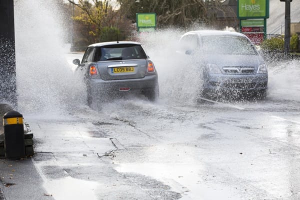
London hit with two weather warnings as strong winds and torrential rain set to sweep capital
Yellow weather warnings for wind and rain forecast Thursday across large parts of England and Wales, bringing high gusts, heavy rain, flooding, and travel disruptions.


fromLos Angeles Times
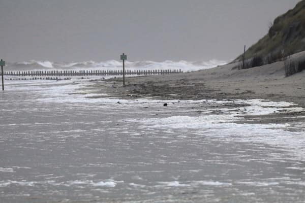
2 months agoStrong storm set to pummel L.A. with heavy rains, flooding and beach hazards
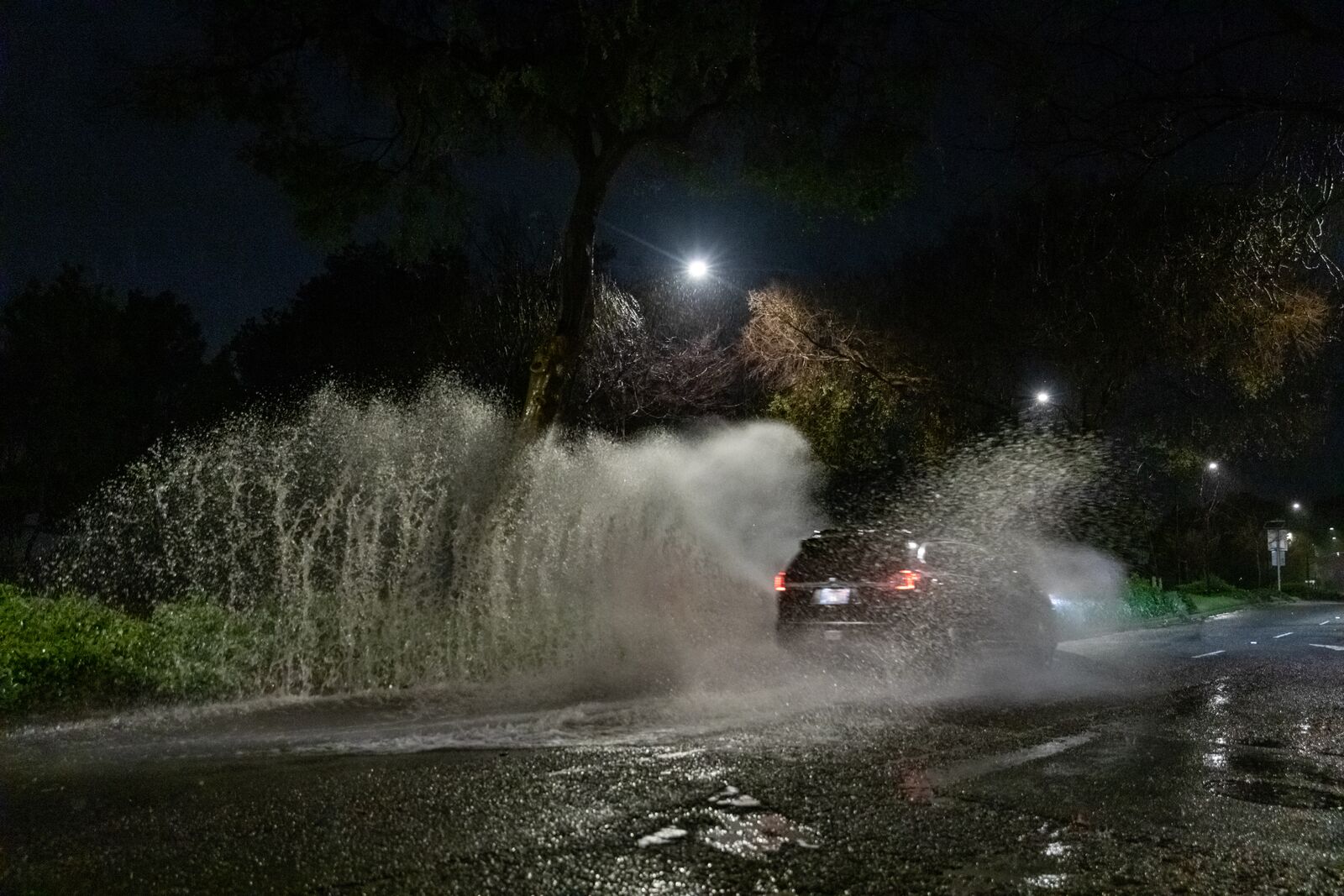
A powerful storm system arrives Sunday with heavy rain, thunderstorms and dangerous waves, posing threats of flooding and debris flows through early next week. The strongest impacts hit late Sunday through Monday, with 1-2 inches of rain expected in valleys and coasts, twice as much in mountains. High-surf advisory expected Monday through Thursday, with waves exceeding 10 feet across all Southern California beaches and a 20-30% chance of damaging sets midweek.
Environment


Miscellaneous
fromIrish Independent
2 months agoRain warnings for seven counties today with further flooding expected, but Met Eireann says bank holiday weekend 'won't be a washout'
Flooding warning for Carlow, Dublin, Kilkenny, Louth, Wexford, Wicklow and Waterford from noon to 11:59pm Friday due to heavy rain and rapid runoff.


fromwww.theguardian.com
3 months agoThe sound of mayhem': witness to New Zealand landslide describes almighty cracking'
It was the almighty cracking that they heard first, an unmistakable deep rumble before the mountain gave way, swallowing up caravans and cars as it collapsed at speed on the campsite below. Aerial images show the aftermath of the landslide that struck New Zealand's North Island on Thursday a massive piece of brown earth gouged out of the green slope, flattened roofs and a few trees sticking out an unnatural angles.
World news


fromSFGATE
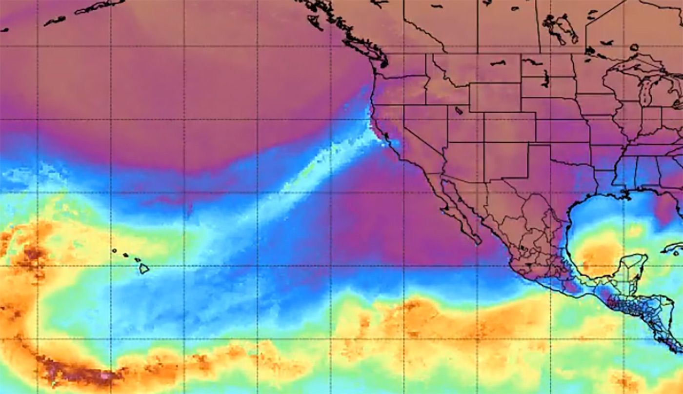
3 months agoCalif. braces for wet New Year's Eve with back-to-back storms, forecasters say
For people traveling on the New Year's Eve, it is going to be rather rainy across the region. We don't expect a lot of major flooding concerns, but we could see potting on roadways, some urban and small swing flooding in areas where there's poor drainage,
California
fromLos Angeles Times
3 months agoRain is coming back to Southern California: A timeline of what to expect
Southern California should be prepared for rain and blustery conditions this week. Residents can also expect to have a rainy New Year's Eve and Day, with rainfall rates from a quarter to half an inch an hour predicted on Wednesday night into Thursday morning. "The chances of a wet New Years Parade, and including the night before when people camp out before the parade, are extremely high, 80-90% at this point," the weather service said in a Monday evening statement.
California


fromsfist.com
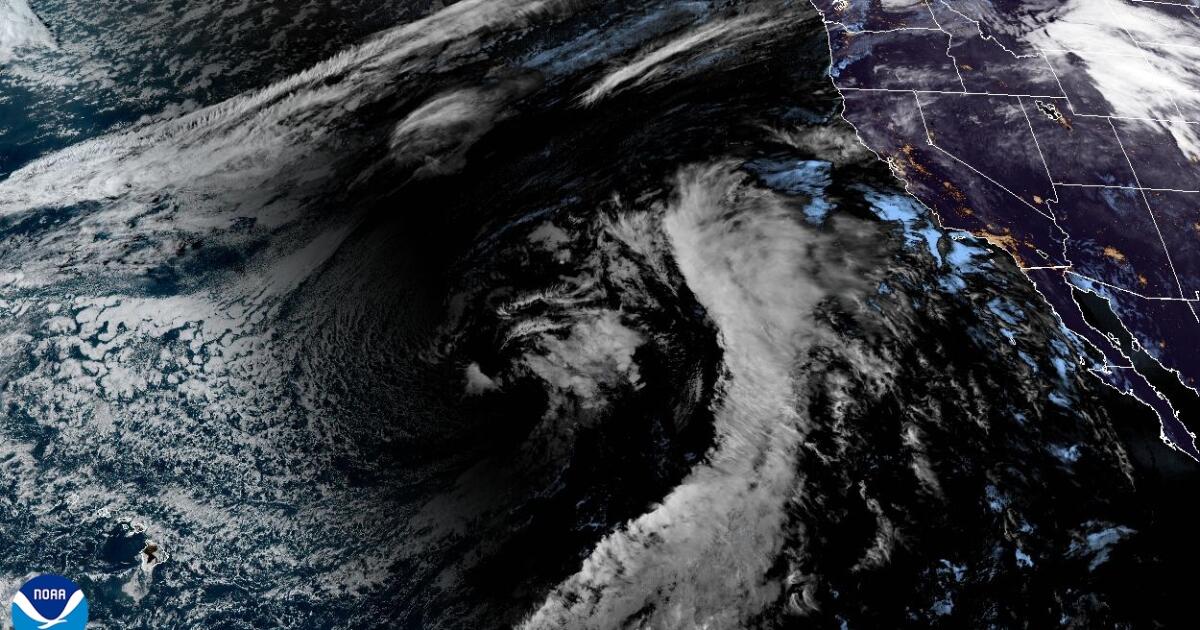
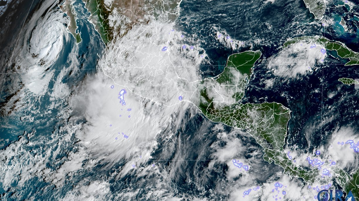
4 months agoTonight's Storm May Qualify as Bomb Cyclone, With Winds Topping 60mph
Meteorologists and their weather models have not come to any agreement about whether Tuesday's incoming storm will meet the criteria of a "bomb cyclone," but suffice it to say it will be really windy and wet. There is a huge area of low pressure out over the Pacific Ocean, carrying with it wind, rain, and potential thunderstorms, and it is scheduled to hit the Northern California coast with a vengence by 7 pm.
Science


UK news
fromLondon Business News | Londonlovesbusiness.com
4 months agoRain warnings issued for persistent heavy rain - London Business News | Londonlovesbusiness.com
Northwest UK will experience persistent heavy rain and strong winds this weekend, with severe warnings, significant accumulations in Cumbria, and potential flooding.
UK news
fromLondon Business News | Londonlovesbusiness.com
4 months agoYellow weather warnings in place for heavy rain - London Business News | Londonlovesbusiness.com
Yellow warning for heavy, persistent rain across parts of north Wales, southwest Scotland and northwest England with possible localised flooding and travel disruption.
Environment
fromLondon Business News | Londonlovesbusiness.com
4 months agoFurther weather warnings in place as Storm Bram brings 'very strong winds' - London Business News | Londonlovesbusiness.com
Heavy rain and severe gales will affect northern and western UK with amber and yellow warnings; winds up to 90mph and very mild temperatures expected.
fromIrish Independent
4 months agoStatus Orange warnings as Storm Bram to bring 'very windy and stormy conditions' to Ireland
Met Éireann has said they are "closely monitoring a developing Atlantic system". "[The system] potentially bringing very strong winds, high coastal water levels and heavy rainfall to Ireland from late tomorrow night, December 8, through Tuesday, December 9." Meteorologist Holly O'Neill said the system has the potential to be a "very impactful event". "A deepening low-pressure system will impact Ireland from Monday night and into Tuesday, which will see very strong winds and heavy rainfall at times," she said.
Miscellaneous
fromIrish Independent
4 months agoStorm Bram: 'Potential to be very impactful' - Met Eireann issues Status Orange and Yellow wind warnings
Storm Bram will bring very strong to gale force southerly winds with the strongest winds along the coast. All counties will see very strong and gusty winds coming into place at 3am tonight until 9pm tomorrow. A Status Orange Wind warning will be in place for counties Cork, Kerry, Waterford and Wexford from 7am tomorrow until 3pm. While another Status Orange Wind Warning will be in place for counties Clare, Limerick, Donegal, Galway, Leitrim, Mayo and Sligo from 10am to 6pm.
Environment
Environment
fromLondon Business News | Londonlovesbusiness.com
4 months agoMet Office warns of heavy rain and strong winds - London Business News | Londonlovesbusiness.com
Yellow rain warning for Monday 8 December for parts of south/central England and south Wales; heavy rain may cause flooding and travel disruption.

UK news
fromLondon Business News | Londonlovesbusiness.com
5 months agoHeavy and persistent rain to dominate the week before it turns cold - London Business News | Londonlovesbusiness.com
The UK will experience unsettled weather this week with heavy rain, strong southerly winds, possible flooding, and cooler, near-freezing temperatures moving in from the north.
Environment
fromIrish Independent
5 months agoMet Eireann extends rain warning to eight counties, as overnight temperatures to drop to 1C
Status Yellow rain warnings issued for Cork, Kerry, Waterford, Wexford, Carlow, Kilkenny, Wicklow and Tipperary with heavy rain, localised flooding risk and travel disruption.


fromwww.bbc.com
6 months agoWeather warnings issued as potential named storm forecast to affect the UK
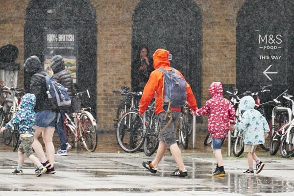
Heavy rain will spread in across southern England late on Wednesday, spreading north-east and likely to persist right through until late Thursday. The Met Office yellow warning for rain covers much of southern and eastern England from midnight on Wednesday night into Thursday, and through until 21:00 BST. Rainfall totals by early Thursday morning could be widely 20-30mm (around 1in), and for some places 30-50mm (up to 2in).
Miscellaneous
fromLondon Business News | Londonlovesbusiness.com
6 months agoYellow national severe weather warnings for wind and rain issued - London Business News | Londonlovesbusiness.com
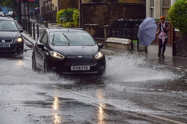
Low pressure moving across the south of the UK on Thursday will bring both a spell of heavy rain and areas of strong winds. The rain is expected to arrive from the southwest during Wednesday evening, before spreading northeast to many parts of England and Wales during Thursday, leading to difficult driving conditions and the risk of flooding in a few places. At the same time, winds are expected to pick up along south coastal areas in particular.
Environment
fromSFGATE
6 months agoHundreds of flight delays hit SFO as storm rolls into Bay Area
A string of disruptive weather conditions has forced a ground delay at San Francisco International Airport on the tail end of the holiday weekend. Beginning at 10:45 a.m. Monday, the Federal Aviation Administration enacted a ground stop at SFO caused by low-ceiling clouds. SFO is "dealing with some southwesterly winds which can be impactful as well, but the ground stop is due to low ceilings, so, with that, we are expecting that to persist," National Weather Service forecaster Dalton Behringer told SFGATE.
San Francisco


fromLondon Business News | Londonlovesbusiness.com
6 months agoStorm Amy to impact the UK bringing strong winds and heavy rain - London Business News | Londonlovesbusiness.com
Although there is still some uncertainty about the exact track Storm Amy will take, the system will bring gale force winds across northern and western regions, with gusts widely reaching 50 to 60 miles per hour inland in northern Britain, and potentially reaching 70 to 80 miles per hour in places. With even stronger gusts on exposed coasts and hills, mainly in the northwest.
Environment
[ Load more ]