#heat-maps
#heat-maps
[ follow ]
fromwww.theguardian.com
4 days agoHeatwave threatens to shatter high-temperature records across eastern US
The near-record temperatures are expected to last into this weekend, forecasters say. While it's not unprecedented to see high temperatures climb toward 90F on an April day, the length of such an April heatwave is rarely seen.
Washington DC
fromArchDaily
5 days agoMapping the Technosphere: Architecture as an Interface Between Systems and Territories
Architecture can no longer be conceived as an isolated object, detached from the technical networks that sustain contemporary life. This condition calls for new readings and approaches.
Design
Europe news
fromenglish.elpais.com
1 week agoFrom the nighttime lights of the rich to the blackouts caused by crises, this is how satellites capture the heartbeat of society'
Light pollution is increasing globally, but some regions are experiencing a decrease due to crises or effective environmental policies.
#google-maps
Roam Research
fromSearch Engine Roundtable
1 month agoGoogle Rolls Out "Ask Maps" in Google Maps
Google Maps introduces Ask Maps, an AI-powered feature using Gemini to help users research businesses, plan trips, and get recommendations, now rolling out in the U.S. and India on mobile with desktop coming soon.


fromFast Company
2 weeks agoSee it: Air temperatures and pollution around the world are captured in real time in these animated weather maps
We created Earth in Action to provide a lens into what's happening on our planet, as it happens. Whether it's something typical, like the current air temperature, or an extreme event like a major dust storm, we wanted to provide an opportunity for people to see them.
OMG science
fromArchDaily
1 week agoFrom Data to Digital Twins: Japan's PLATEAU Project Offers Open-Access Models of More Than 250 Cities
Project PLATEAU, led by Japan's Ministry of Land, Infrastructure, Transport and Tourism, aims to develop and expand access to 3D models representing the diversity of cities across the country, enhancing urban resilience and addressing local challenges.
Data science
Business intelligence
fromLondon Business News | Londonlovesbusiness.com
2 weeks agoWhy GIS matters in modern infrastructure and urban planning: Building smarter, future-ready cities - London Business News | Londonlovesbusiness.com
GIS is essential for effective urban planning, enabling data-driven decisions that enhance infrastructure and quality of life in rapidly growing cities.
Arts
fromThe Art Newspaper - International art news and events
1 month agoNew book shows why physical maps have an important role to play in our digital world
A cartography professor discovered 96 historically significant maps in a forgotten university archive, revealing cartography's vital role in preserving sociopolitical memory and demonstrating maps' importance beyond navigation.
fromwww.theguardian.com
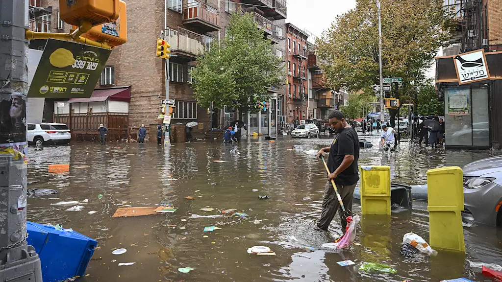
1 week agoNon-survivable': heatwaves are already breaching human limits, with worse to come, study finds
When scientists applied a new model of human survivability that takes into account the body's ability to function and stay cool depending on age, they found all six events had seen non-survivable periods for older people who could not find shade.
Environment


Environment
fromFortune
2 weeks agoData centers are so hot, their 'heat island' effect is raising temperatures up to 6 miles away and impacting 343 million people worldwide, study finds | Fortune
AI infrastructure is creating a 'data heat island effect' that raises local temperatures and impacts millions of people.
#weather-forecasting
Apple
fromNieman Lab
1 month agoThe team behind Dark Sky launches a weather app for uncertain, low-trust times
Acme Weather, from Dark Sky creators, displays forecast uncertainty through multiple prediction scenarios instead of single-point forecasts, acknowledging that weather predictions are inherently unreliable.
fromEngadget
1 month agoGoogle built a flash-flood prediction tool using Gemini and old news reports
Google tasked Gemini with sorting through 5 million news articles from around the world and isolating flood reports. It transformed this data into a geo-tagged series of chronological events. Next, researchers trained a model to ingest current weather forecasts and leverage the Groundsource data to determine the likelihood of a flash flood in a given area.
Data science
Artificial intelligence
fromArchDaily
1 month agoCompute Isn't Weightless: AI Infrastructure and the Architecture of the City
AI development is reshaping urban infrastructure and spatial planning in the Greater Bay Area through government-led initiatives that translate computational needs into physical zones, data centers, and specialized districts.
fromTechCrunch
1 month agoGoogle is using old news reports and AI to predict flash floods | TechCrunch
While humans have assembled a lot of weather data, flash floods are too short-lived and localized to be measured comprehensively, the way the temperature or even river flows are monitored over time. That data gap means that deep learning models, which are increasingly capable of forecasting the weather, aren't able to predict flash floods.
Science
Software development
fromBusiness Matters
2 months ago5 Reasons Why Maptive is The Best GIS Platform for Location Intelligence
Maptive transforms spreadsheet location data into fast, browser-based interactive maps and optimized routes, delivering accessible location intelligence without specialized GIS expertise.


fromHeat.js
2 months agoHeat.js : JavaScript Heat Map
Completely free and open source (view our licence here). data_object Supports export for integration with frameworks including React, Vue, and Angular. Fully configurable, featuring custom triggers and adjustable text to support multiple language locales. 60 languages supported by default (view the languages here). Includes multiple views, including Map, Line, Chart, Days, Months, and Color Ranges. export_notes Export data to multiple file formats (view the supported types here), with system clipboard setting support.
Web design
fromwww.theguardian.com
1 month agoExtreme heat lab: enduring the climate of the future
"So whenever people think about hot weather, they always talk about the temperature," he says. "There's two issues with that. First of all, most people don't realise that the temperature is measured in the shade. So if you're in direct solar radiation, the amount of heat stress you're exposed to is much greater as it will stress your body out a lot more."
Public health
New York City
fromFast Company
1 month agoMIT researchers just mapped New York City foot traffic for the first time ever
A comprehensive pedestrian model maps foot traffic across all NYC sidewalks, revealing movement patterns and crash vulnerabilities and enabling people-focused transportation planning and funding shifts.
fromNature
1 month agoObserving the tidal pulse of rivers from wide-swath satellite altimetry - Nature
Along coastlines, where tides are typically magnified, they profoundly affect navigation, commerce, coastal flooding, water properties and sediment transport. Tides impact the flooding of rivers and, thus, influence the extent of their floodplain, which has cascading effects on biogeochemical and ecological processes.
Environment
fromThe New Yorker
2 months agoWhat Happens When the Snow Doesn't Melt?
This past week in New York City, fifteen inches of snow fell and more than twenty-two hundred snowplows pushed it away. Twelve thousand miles of sidewalk were shovelled. Two hundred and nine million pounds of salt were spread, and, after it got really bad, two hundred thousand gallons of calcium chloride, a chemical ice melt, were deployed. Sometimes the work you do leaves its mark; sometimes it doesn't.
New York City
fromThedrum
2 months agoHyper-local measurement to optimise catalogue effectiveness
They were trying to get to the bottom of how to diminish catalogue distribution without having a negative impact on store and online sales. They were also keen to define the geographic areas where digital content would work best and how to profile those areas to classify digital purchase behaviour. Together with Analytic Partners they were able to uncover opportunities to eliminate 22% of catalogues with negligible sales impact and increasing digital support in high-performing topologies, preserving€ 294 million in sales.
Marketing tech
Data science
fromLondon Business News | Londonlovesbusiness.com
2 months agoIs Maptive the best mapping software to conduct complex spatial analysis - London Business News | Londonlovesbusiness.com
Maptive delivers cloud-based, no-code spatial analysis and mapping that handles large datasets, automated territories, route planning, and enterprise-grade global mapping infrastructure.
Environment
fromwww.theguardian.com
1 month agoA sobering preview': extreme heat now affects one in three people globally, study finds
One-third of the world's population now lives in areas where extreme heat severely restricts safe daily activities, with elderly people experiencing over 900 hours annually of heat-limited outdoor time.
fromNature
1 month agoThe world is getting hotter faster - its pace nearly doubled in the past decade
Because the past three years have shattered temperature records, researchers have been exploring whether global warming is accelerating, and if so, why. Many scientists agree that the rate at which it is increasing has picked up. This is mainly because of a reduction in air pollution following the introduction of fuel regulations for international shipping (which has resulted in fewer pollutant particles that reflect sunlight into space and seed insulating clouds).
Environment


fromwww.theguardian.com
1 month agoAnalysis finds urban areas in England where no one lives within 15-minute walk of nature
While the data shows 80% of people live within walking distance of green or blue spaces such as a river, park or woodland, it also reveals a disparity between rural and poorer urban areas. In some areas of local authorities, fewer than 20% of residents live close to these spaces, according to data released by the Department for Environment, Food and Rural Affairs on Wednesday.
Environment
fromwww.nature.com
2 months agoAtmospheric H2 variability over the past 1,100 years
Warwick, N., Griffiths, P., Keeble, J., Archibald, A., & Pyle, J. Atmospheric implications of increased Hydrogen use. GOV.UK https://www.gov.uk/government/publications/atmospheric-implications-of-increased-hydrogen-use (2022).
Environment
Environment
fromState of the Planet
2 months agoHarnessing AI, Scientists Discover a Rise in Floating Algae Across the Global Ocean
Floating algae blooms have increased globally since about 2008–2010, driven by warming oceans, changing currents, and nutrient pollution, with coastal ecological and economic harms.
[ Load more ]