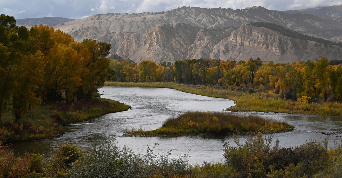
#snow-drought
#snow-drought
[ follow ]
#climate-change #snowpack #california #water-supply #drought #sierra-nevada #weather #skiing #wildfires

fromHigh Country News
21 hours agoWildfires make soil poisonous - High Country News
Researchers have known since at least 2008 that wildfires can create chromium-6, but a new study, published in the journal Environmental Science and Technology in November, is the first to report details such as how long it might persist in groundwater.
Environment


fromSnowBrains
2 hours agoSnowBrains Forecast: Up to 10 Inches on the Highest PNW Terrain Midweek - SnowBrains
Timberline is the clear winner for open terrain with around 7-9 inches, while Mt. Bachelor picks up 4-5 inches but remains closed. Most Washington resorts look too warm or too dry for meaningful new snow.
Snowboarding


fromSnowBrains
1 day agoSnowBrains Forecast: Light High-Elevation Snow for South America Through Tuesday - SnowBrains
The ongoing Sunday night into Monday storm across the central Andes keeps producing mainly upper-mountain snow through Monday before tapering out by Tuesday morning, April 21. A realistic near-term outcome is about 16-20 cm at Las Leñas, 9-11 cm at Valle Nevado, and lighter 5-8 cm amounts around El Colorado, La Parva, and Portillo.
Snowboarding


fromUnofficial Networks
1 day agoThese Skier Crosswalks Are The Peak Of Ski-Centric Infrastructure
Having the ability to ski all the way home after a day on the mountain is a rare and incredibly opportunity. Knowing you can ski right to your front or back door makes a ski trip all that much better.
Snowboarding


Skiing
fromABC7 San Francisco
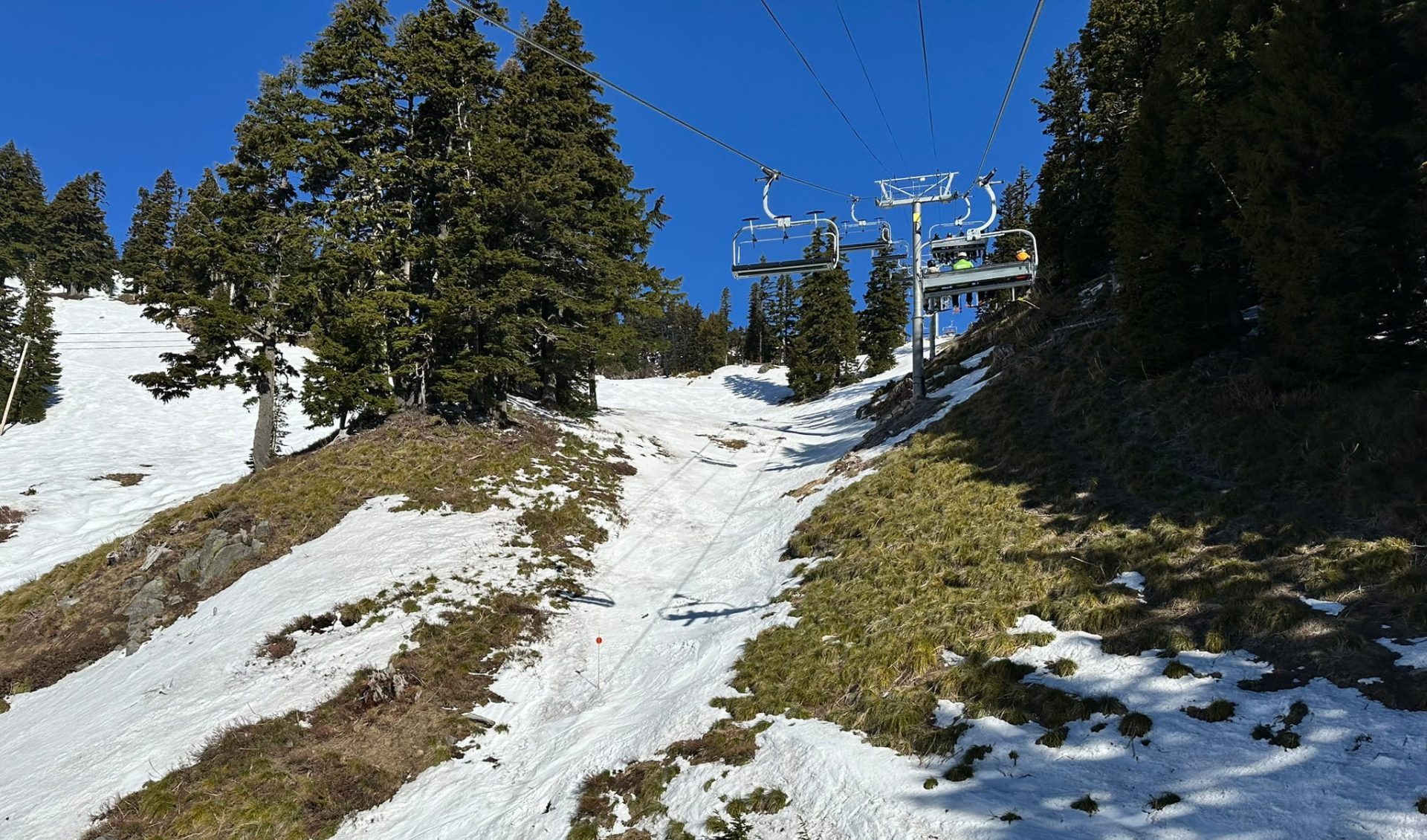
1 month agoShortening ski season: Sierra Nevada snowpack melting at 1% per day, officials say
A heat wave is rapidly melting Lake Tahoe's already-depleted snowpack at 1% daily, threatening to create the second-lowest April 1st measurement in history, with cascading impacts on water supply, wildfire risk, drought conditions, and ski season viability.
fromSnowBrains
5 days agoSnowBrains Forecast: Light BC Snow, 10-20 Centimeters in Alberta Through Friday for BC/Alberta - SnowBrains
The ongoing storm is expected to add 13-16 cm at Banff Sunshine and around 4-5 cm at Lake Louise by Friday morning, with the deepest moisture focused on Alberta.
Snowboarding
fromHigh Country News
1 month agoA shrinking Colorado River is forcing farms to change - High Country News
The Colorado River is an interconnected system, sustained by Rocky Mountain snowpack, rainfall and groundwater. It is fragile, and under increasing stress. Two and a half decades into this century, the river that built the modern West has 20% less water flowing through it than it did on average in the last century. As heat and drought intensify, so do the stakes: Failure to recognize the severity of changing conditions, managing the river in parts without considering needs of the whole and inadequate planning for long-term shortages put the future of all the basin at risk.
Agriculture
#california-water-crisis
Environment
fromLos Angeles Times
1 month agoCalifornia's snowpack was already meager. Now comes an extraordinary heat wave
California's Sierra Nevada snowpack is at 48% of average due to an extremely warm winter, with rapid melting accelerated by an incoming heat wave threatening the state's water supply.
Agriculture
fromwww.pressdemocrat.com
1 month agoLow snowpack, higher temperatures cause concern for Bay Area scientists, farmers
California needs significant March rain and snow to restore water resources after an unusually warm winter, despite February storms improving reservoir levels to 70-80% capacity.
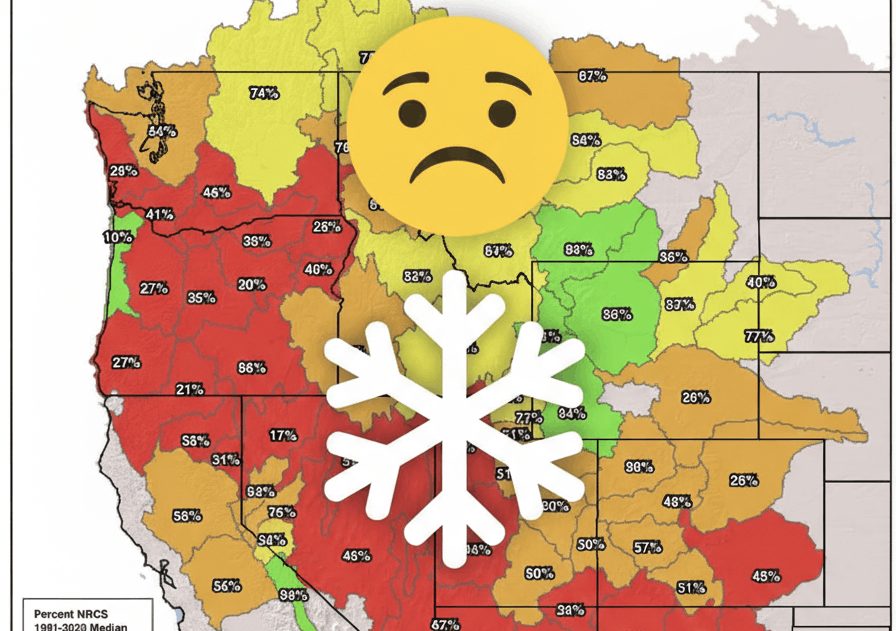
fromArs Technica
3 weeks ago2026's historic snow drought is bad news for the West
Data from the US Department of Agriculture's Natural Resources Conservation Service shows that out of approximately 70 river basins across the Western US, only five are at or above the 1991-2020 median snow water equivalent for this time of year.
Snowboarding
California
fromThe Mercury News
1 month agoSierra Nevada snowpack just 68% of normal after whiplash winter, but water supplies are OK, experts say
California's winter weather has been extremely volatile, with alternating dry and snowy periods leaving the Sierra snowpack at 68% of historical average despite previous wet years filling reservoirs above normal levels.


Snowboarding
fromSnowBrains
1 month agoSnowBrains Forecast: Springlike, Mostly Dry Pattern for Colorado Through Sunday - SnowBrains
Colorado ski resorts face warm, dry spring conditions through Sunday with afternoon temperatures in the upper 40s to 60s, minimal snowfall, and periodic ridge winds of 25-40 mph.


fromSFGATE
1 month agoThe surprising element that's boosting California's stubbornly low snowpack
SWE is the most important metric for all of our water resources. It's the metric that we deal with the most and the one that the entirety of the snow research and operations community is working to get right. So, seeing an increase in SWE like that, even if it's from mid-winter rain, is a great thing because that means we have more water stored in the snowpack moving forward.
California
California
fromLos Angeles Times
2 months agoFirst wave of nearly a week of rain hits Southern California. Snow expected for Mammoth, Tahoe
Southern California experienced heavy rains with flood watches, wind advisories, burn-scar evacuation warnings, and forecasts of significant rainfall and mountain snow this week.
fromSFGATE
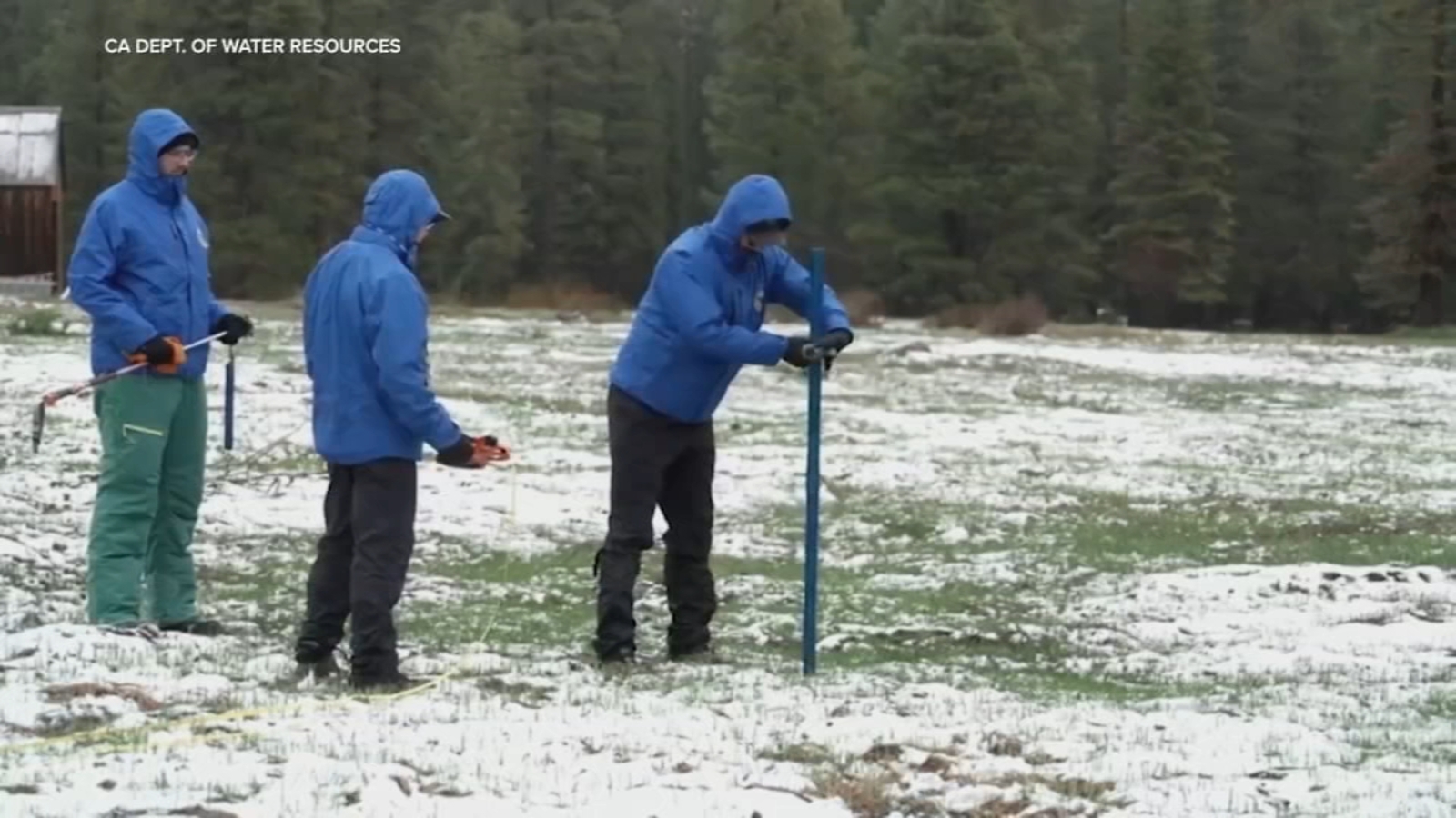
2 months agoHistorically warm, dry January erases snowpack gains in Sierra Nevada
"A dry January, which is historically the wettest month of the year in California, has now eroded the gains made at the start of the year and forecasts currently show no major precipitation in the next two weeks," California Department of Weather Resources spokesperson Jason Ince wrote in a Jan. 30 news release. The first month of the year certainly left the area warmer and drier than usual, weather officials confirmed.
Environment
Snowboarding
fromSnowBrains
1 month agoSnowBrains Forecast: Quick 5-10 Inches for Parts of Colorado This Weekend, Then Warm and Dry - SnowBrains
Colorado ski areas face warm, windy conditions through Saturday, followed by a modest snow refresh Saturday night favoring northern and central mountains, then warming returns next week.
Environment
fromThe Mercury News
1 month agoLow snowpack, higher temperatures cause concern for Bay Area scientists, farmers
March precipitation in higher elevations is critical for California's water security as snowpack remains significantly below average despite February storms and warm winter conditions.
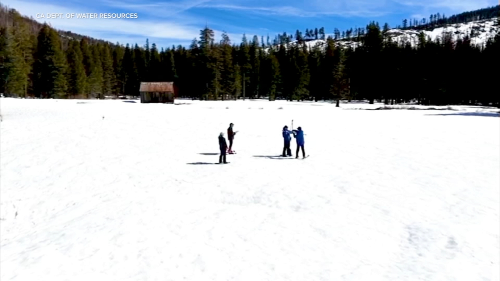
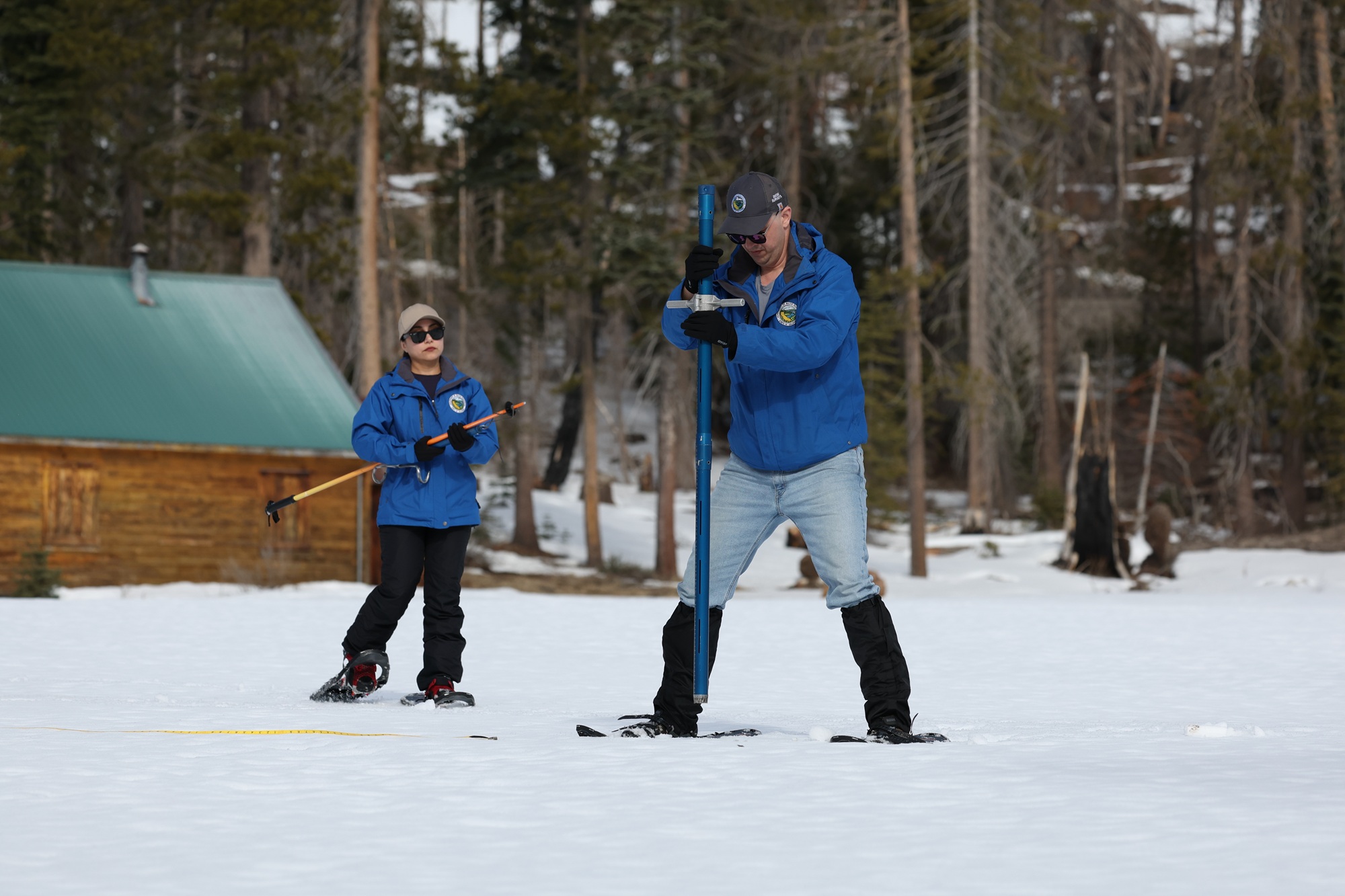
fromSnowBrains
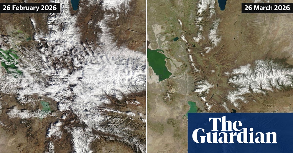
2 months agoNASA: The West Faces Snow Drought - SnowBrains
This image, acquired with the MODIS (Moderate Resolution Imaging Spectroradiometer) on NASA's Terra satellite, provides a wide view of meager western snow cover on January 15. On that day, measurements derived from satellite observations showed that snow blanketed 142,700 square miles (369,700 square kilometers) of the west. That's the lowest coverage for that date in the MODIS record dating back to 2001 and less than one-third of the median. Coverage had increased slightly by January 26.
Snowboarding
fromSnowBrains
1 month agoCan Colorado's Snowpack Catch Up? - SnowBrains
To get back to average snowpack, we essentially need to have the most snow that we've ever had for the last 30 years between now and mid-April. It would be extremely difficult for Colorado to get back to a normal/average snowpack. As an example, when looking at the Independence Pass SNOTEL site in central Colorado outside of Aspen, we typically have 13 inches of snow-water-equivalent at the end of February. This year, we only have 6.7 inches of SWE.
Snowboarding
Snowboarding
fromSnowBrains
1 month agoHow Will This Winter Affect the 40 Million People Living in the Colorado River Basin? - SnowBrains
Western ski areas face a poor snow year despite recent storms, threatening water supply for 40 million people across the Colorado River Basin through reduced snowpack and summer streamflow.
Snowboarding
fromSnowBrains
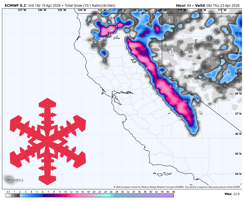
1 month agoSnowBrains Forecast: A Dusting for the California Sierra Midweek, Then Dry and Warmer - SnowBrains
A weak midweek system brings light snow to California Sierra Wednesday-Thursday, followed by dry, warming conditions through the weekend with periodic ridge winds affecting exposed terrain.
Snowboarding
fromSnowBrains
1 month agoMarch 2026 State of the Western U.S. Snowpack: Showing Slight Improvement But Still Below Average - SnowBrains
Western U.S. snowpack remains below average overall, with Oregon, Nevada, Arizona, and New Mexico severely depleted, while Eastern Sierra and Western Wyoming show stronger conditions.
[ Load more ]